Ordnance Survey provide free data via the OS OpenData programme and paid for premium data such as MasterMap.
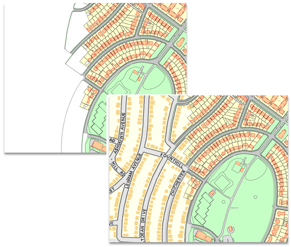
When you build your Ordnance Survey stack with scale thresholds it is likely that you will have large areas of white space when viewing MasterMap. i.e. your MasterMap data is visible up to a scale of 2,500, Street View between 2,500 to 10,000 and so on.
It is likely you will only have local coverage of MasterMap so as you pan to the edge of this data you have no mapping – white space. The solution is to remove a minimum scale threshold for Street View so you see both Street View and MasterMap. However you will notice that Street View becomes visible through MasterMap.
To rectify this display the Overlays dialog for the MasterMap overlay, on the Styles tab check the tickboxes for Transparency Overrides for Brushes and Pens:
![]()
This will remove all transparency on MasterMap. Now you will have continuous mapping without any white space.
Send comments on this topic.
Click to return to www.cadcorp.com
© Copyright 2000-2017 Computer Aided Development Corporation Limited (Cadcorp).