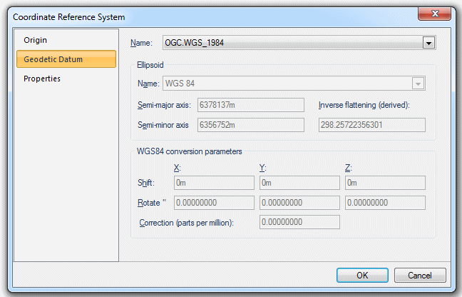
A Geodetic Datum is a set of parameters defining coordinate systems for local parts of the Earth or for all of the Earth. Different datums have been produced and revised over time. They are used to produce a better local fit of a spheroid to the actual shape of the Earth (the geoid).
See Geodetic lines and buffers.
Many different datums have been produced, and they are provided as named objects in the (standard) library. You can create your own custom geoid datum by copying an appropriate one from the (standard) library into one of your own editable libraries. You may then edit it, and rename it as required.
Examples are ED50 (the European datum for 1950) and WGS84 (the World Geodetic System for 1984).
You can create editable copies of the existing coordinate reference systems and amend them as you wish. For example, you might want to use the Equidistant Conic coordinate reference system, but on a different part of the Earth. It uses the parallel 55° North as its Latitude origin - you could change this in order to use the coordinate reference system at a different location:

Click to return to www.cadcorp.com
© Copyright 2000-2017 Computer Aided Development Corporation Limited (Cadcorp).