Manage CRS
Manage CRS allows you to add, remove or edit existing Coordinate Reference Systems.
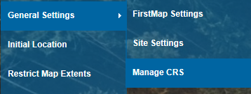
Select General Settings > Manage CRS from the What would you like to do? drop-down menu:
This displays the Manage Coordinate Reference Systems dialog:
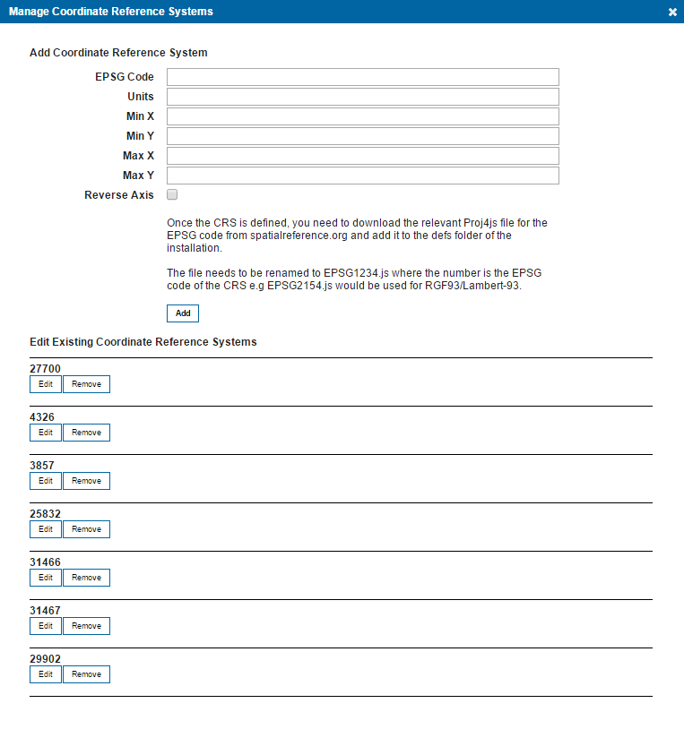
The Manage Coordinate Reference Systems dialog gives three options:
- Add a new Coordinate Reference System
- Edit Existing Coordinate Reference System
- Remove a Coordinate Reference System
Add a new Coordinate Reference System
For example, to add EPSG:2154:
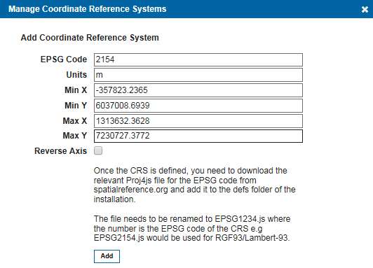
Enter:
EPSG Code, in this case 2154
Units, in this case m
Min X, in this case -357823.2365
Min Y, in this case 6037008.6939
Max X, in this case 1313632.3628
Max Y, in this case 7230727.3772
Reverse Axis, check tickbox if required.
Click Add.
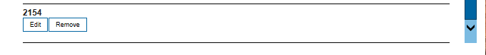
2154 will now be added to the list and can be edited if required.
EPSG is a globally recognised dataset of coordinate references. Web Map Layers 8.0 comes pre-loaded with these popular EPSG codes.
| 27700 | British National Grid |
| 4326 | World |
| 3857 | World (used in rendering map tiles for Bing and Google Maps) |
| 25832 | Europe |
| 31466 | Germany (Gauss-Krüger zone 2) |
| 31467 | Germany (Gauss-Krüger zone 3) |
| 29902 | Ireland |
| 28355, 28354, 28353, 28352, 28351, 28350 | Australia |
Edit a Coordinate Reference System
Click Edit to display the details for the Coordinate Reference System as shown for the Add a new Coordinate Reference System, shown above. These values can now be edited.
Remove a Coordinate Reference System
Click Remove to delete the Coordinate Reference System. A confirmation message will be displayed before the Coordinate Reference System is removed.
Send comments on this topic.