Troubleshooting
Repairing a WMTS data layer shift error
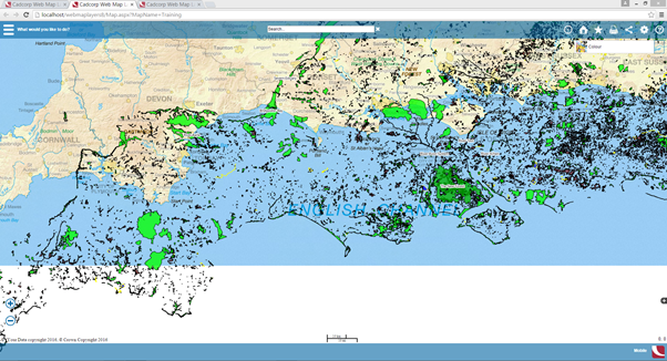
If WMTS data layers are shifted this will result in a map display similar to the following, in this case the top left coordinates will need to be reset to correct the alignment.
To reset the coordinates proceed as follows:
Select Maps > Add Map
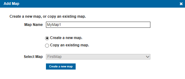
Enter a Map Name.
Select the Create a new map radio button
Click the Create a new map button.
Select Layers > Add Layers
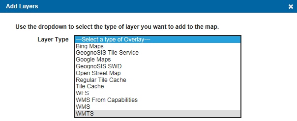
Select WMTS from the Layer Type drop-down list.
The Add Layers dialog will change as follows, the red boxes shows the entries you will now make.
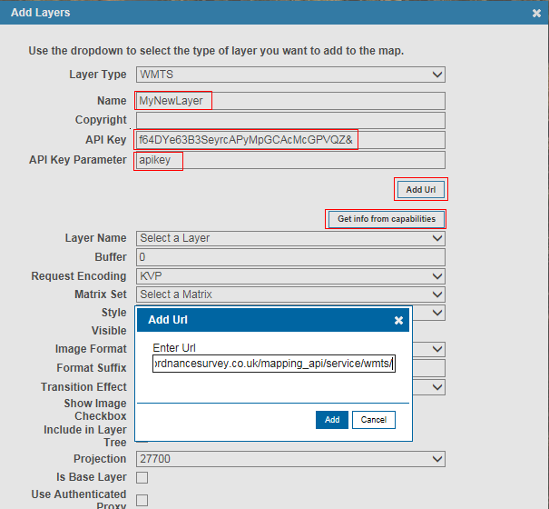
Layer Type will be WMTS
Enter a Name, in this example MyNewLayer is used.
Enter your API Key.
Enter your API Key Parameter, in this example apikey is entered.
Click Add Url, the pop-up Add Url dialog will appear, enter the Url
Enter url, the Url iused n this example is https://api.ordnancesurvey.co.uk/mapping_api/service/wmts/, and click the Add button.
Cllick the Get info from capabilities button, the wmts-capabilities.xml file will be downloaded.
Continue with the Add Layers dialog entries:
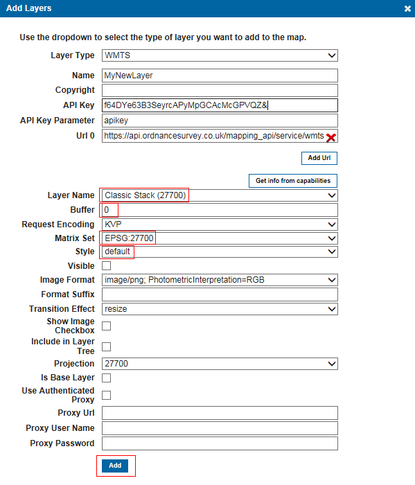
Layer Name - in this example Classic Stack (27700) is selected.
Buffer - enter the buffer around each tile, in this example a value of 0 is entered.
Matrix set - in this example EPSG:27700 is selected.
Style - select default.
Click Add.
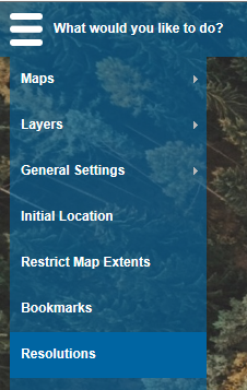
Go to the Resolutions tab:
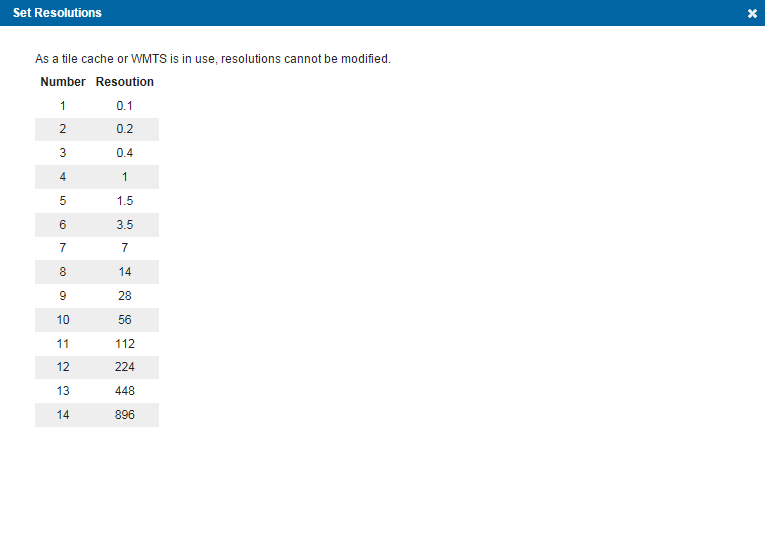
The Set Resolutions screen will be displayed showing available resolutions from 0.1 to 896.
Send comments on this topic.