Customising Coordinate Reference System
A Coordinate Reference System is a method of projecting positions in the world onto screen/paper.
SIS Desktop 9 lets you create Coordinate Reference System objects and save them in Named Object Libraries using names.
Click the CRS icon on the status bar to see available coordinate systems.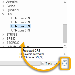
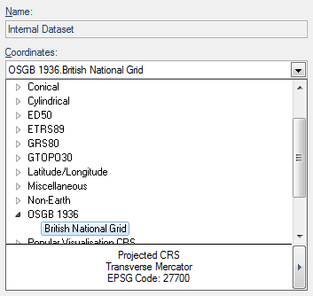
Alternatively select Overlays > Dataset > Coordinates drop-down list.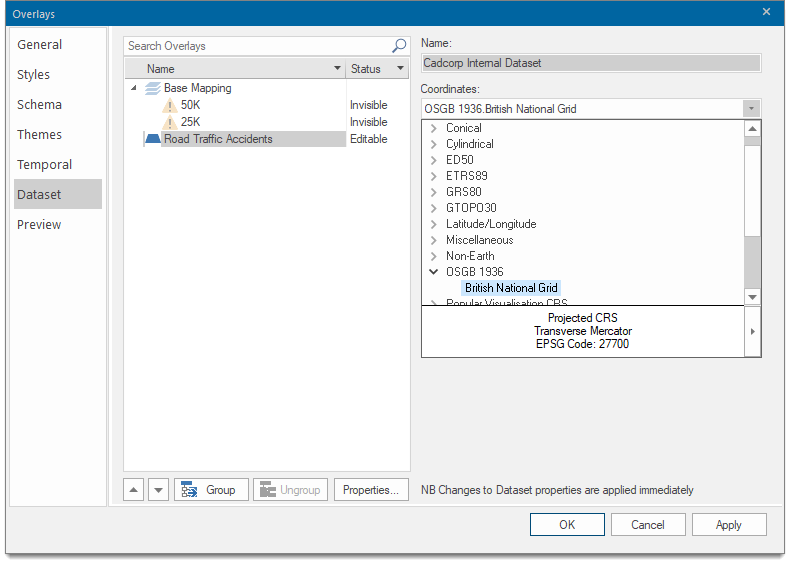
To open more options, click on the right button at the bottom. This opens the Coordinate Reference System dialog.
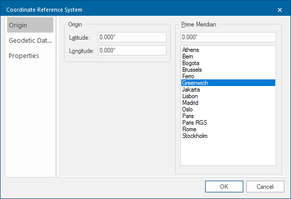
1. Origin
Origin tab
| Option | Description | |
| Latitude | The latitude of the origin of the coordinate reference system. | |
| Longitude | The longitude of the origin of the coordinate reference system. | |
| Prime Meridian | Prime Meridian that the coordinate reference system is based on, relative to Greenwich. A list of Standard Prime Meridians is shown. | |
Geodetic Datum tab
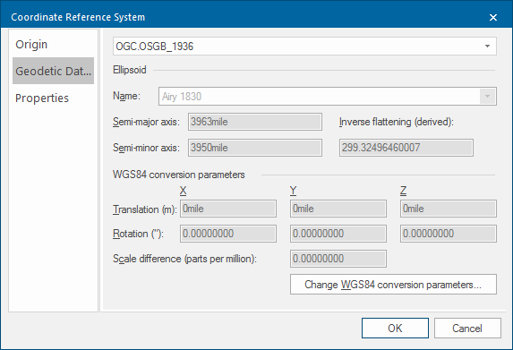
A Geodetic Datum (sometimes called simply a Datum) models the sea-level surface more accurately than an ellipsoid.
SIS Desktop 9 contains equations for transforming points between Geodetic Datums or you can make your own Geodetic Datums by applying seven conversion parameters to the WGS84 standard Geodetic Datum.
| Option | Description | |
| Ellipsoid Name | Reference ellipsoid name, i.e. Airy 1830 in this example. | |
| Semi-major axis | Distance from centre of ellipsoid to any point on the equator in metres. | |
| Semi-minor axis | Distance from centre of ellipsoid to either pole in metres. | |
| Inverse flattening (derived) | Inverse flattening value. | |
|
WGS84 conversion parameters Translation (m) X/Y/Z |
The difference between the X/Y/Z values of a point in the target and source coordinate reference systems. |
|
| Rotation (") |
The angular difference (about the X, Y or Z axis, viewed from the origin) between the other two axes directions of target and source coordinate reference systems. |
|
| Scale difference (parts per million) | The scale difference increased by unity equals the ratio of the length of an arbitrary distance between two points in target and source coordinate reference systems. | |
Press the Change WGS84 conversion parameters... button; this displays the conversion parameter variants information screen:
Properties tab
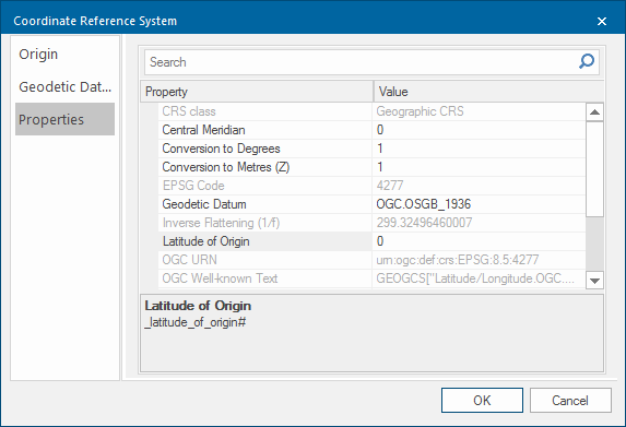
The Properties tab displays all properties of the coordinate reference system.
Properties
Properties
- Class name: _class$
Coordinate reference system class. - EPSG Code: _epsg&
The matching European Petroleum Survey Group (EPSG) code number for the coordinate system, if found. - Projection WKT: _projection$
Coordinate reference system in Open Geospatial Consortium (OGC) Well-Known-Text format.