Relative polar coordinates
coordClass = “AGridBearingRelative”
Coordinates are displayed and entered in Polar coordinates, measured from the last snapped position.
Example: Digitizing a pipe line
First change the format of the Status Bar to show Relative polar coordinates.
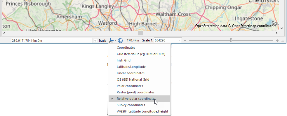
TIP: If the Status Bar is not currently displayed on your screen, select Status Bar to display the bar and Status Bar Configuration Options to configure it.
To begin creating your pipe line select LineString (Create > Simple).
Click on your map at the starting location of the pipe line. You will notice the values in the cursor position display (left-hand box) change when you move the mouse, relative to the selected position (providing the track option tickbox is checked).
The three values are: bearing (degrees), distance (metres) and height or z value (metres).
If you know the location of the next position along the pipe line you can manually enter this into the cursor position display and then press enter to add a new point:

You can repeat this process to add further points along your pipe line, as the cursor position values will relate to the last snapped position. To maintain accuracy snap to existing points of other geometry when appropriate.
Press Enter to finish creating your pipe line. 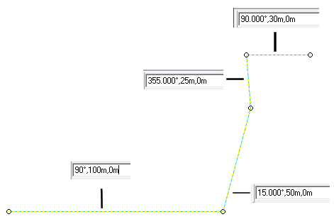
The same method can be used for creating points and polygons where the positions of the vertexes are known in relation to previously added vertexes.