Geodetic Datum
A Geodetic Datum is a set of parameters defining coordinate systems for local parts of the Earth or for all of the Earth.
Different data have been produced and revised over time. They are used to produce a better local fit of a spheroid to the actual shape of the Earth (the geoid).
TIP: See Geodetic lines and buffers
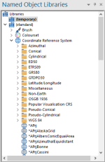
These geodetic data are provided as named objects in the (standard) library.
You can create your own custom geoid datum by copying an appropriate one from the (standard) library into one of your own editable libraries.
Creating your own Coordinate Reference Systems
You can create editable copies of the existing coordinate reference systems and amend them as you wish.
For example, you might want to use the Equidistant Conic coordinate reference system but on a different part of the Earth.
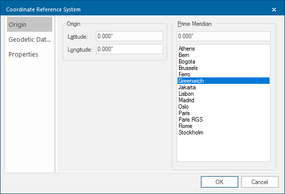
It uses the parallel 55° North as its Latitude origin - you could change this in order to use the coordinate reference system at a different location:
- Select an existing coordinate reference system which most nearly matches the new coordinate reference system you wish to create.
- Use the local menu command Copy to copy it to the clipboard.
- Use local menu command Paste to Paste it into an editable library.
- Use the local command Rename to give it a new name.
- Use the local command Properties... to display the Coordinate Reference System dialog to view and amend the coordinate reference system details.
