OGC Web Coverage Service (WCS)
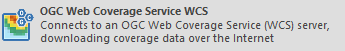
Click Add Overlay > OGC > OGC Web Coverage Service.
This will open the WCS dialog:
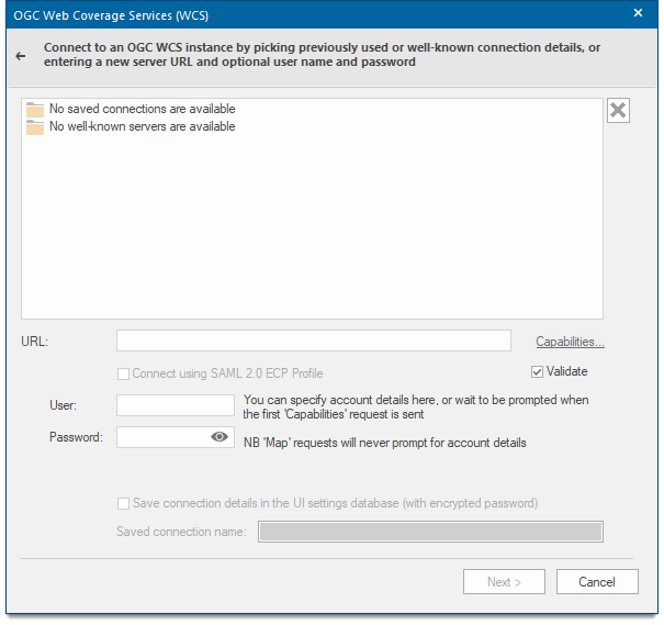
Address of WCS server
Enter the address of the OGC WCS server.
Well-known servers
Select a well known OGC WCS server from the drop-down box.
Validate XML from server
The WMS capabilities document tells clients exactly which layers, styles, extents, image formats, etc. a server supports.
Check this tickbox if you wish the XML returned by the OGC WCS to be validated.
Capabilities...
Displays the XML capabilities document for the OGC WCS in the resizable HTML/XML Viewer dialog, for example:
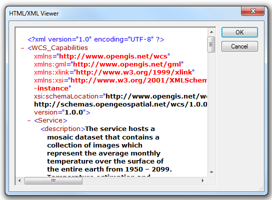
Click OK to return to the OGC Web Coverage Service (WCS) dialog.
Click Next.
The OGC WCS Coverages dialog will be displayed:
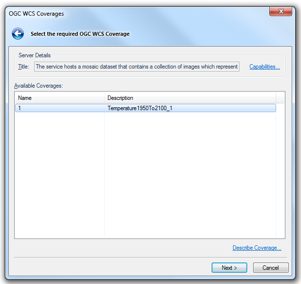
Server Details
Title
This may be a descriptive title returned by the OGC WCS
Describe Coverage...
Displays the XML description of the selected Coverage in the resizable HTML/XML Viewer dialog, for example:
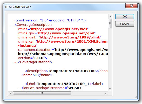
Click OK to return to the OGC Web Coverage Service (WCS) dialog.
Click Next.
The OGC WCS Ranges dialog will be displayed, for example:
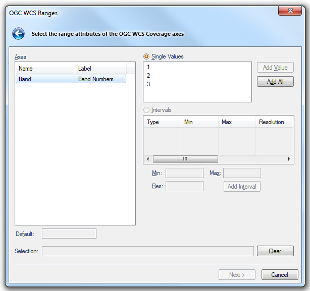
Axes
Displays a list of available Coverage axes.
Single values
Select this option to choose from the list of available Coverages.
Add Value button - Adds the currently selected single value.
Add All - Adds all the available single values.
Intervals
Select this option to choose from the list of available Coverage axis ranges.
Min - Minimum value in the range.
Max - Minimum value in the range.
Res - The resolution of the values in the range
Add Interval button - adds the currently selected range.
Default
Displays the default value for the selected axis.
Selection
The currently selected single value(s) or range(s).
Clear button
Clears the currently selected single value(s) or range(s).
Click Next.
The OGC WCS CRS and BBOX dialog is displayed:
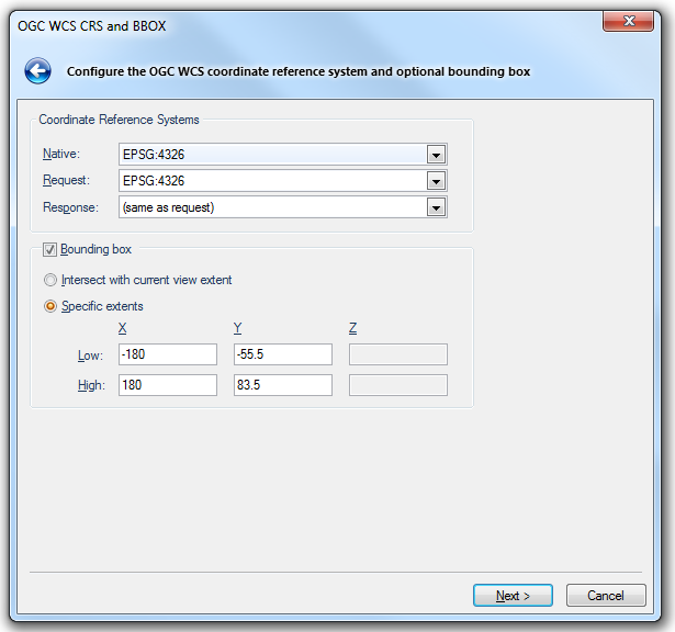
Coordinate Reference Systems
Native
Shows the native CRS of the selected Coverage.
Request
Choose the CRS of the request, e.g. for the bounding box extents, where specified.
Response
Choose the CRS of the response, e.g. to have the OGC WCS reproject the Coverage before returning a result.
Bounding box
Check this tickbox if a bounding box restriction is to be used in the final request.
Intersect with current view extent
Select this option if you want to use the extents of the current Map Window.
Specific extents
Select this option if you want to use specific, typed, extents.
Enter the low and high ends of the X, Y, (and Z if applicable) ranges.
Click Next.
The OGC WCS Coverage dialog will be displayed to enable the request to be configured:
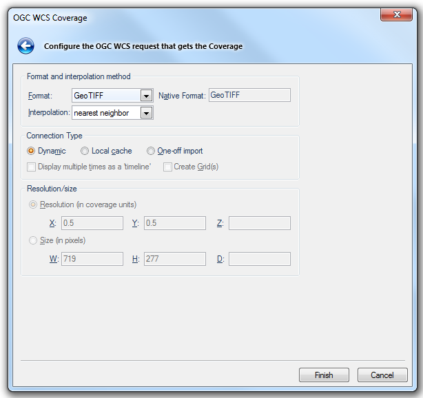
Format and interpolation method
Format
Specifies the Coverage format to return. The list of available formats is dependent on the OGC WCS being used.
Native Format
Shows the native format of the selected Coverage.
Interpolation
Specifies the interpolation method to apply where appropriate, e.g. when requesting a subset of the Coverage at non-native resolution. The list of available interpolation methods is dependent on the OGC WCS being used.
Connection Type
Dynamic Local cache One-off import
Dynamic - Select this connection type if (Undefined variable: Primary.ProdVersion) is to dynamically request Coverages for every redraw in the Map Window.
Local cache - Select this connection type if(Undefined variable: Primary.ProdVersion) is to cache the resulting Coverage on the local client. If the resulting Overlay is saved in an SWD, then(Undefined variable: Primary.ProdVersion) will re-query the OGC WCS, and re-cache the result, each time that SWD is opened.
One-off import - Select this connection type if (Undefined variable: Primary.ProdVersion) is to make a one-off copy of the resulting Coverage, that is completely disconnected from the OGC WCS.
Display multiple times as a 'timeline'
Check this tickbox if you want (Undefined variable: Primary.ProdVersion) to treat multiple temporal values or intervals as a "timeline".
Create Grid(s)
Check this tickbox if you want (Undefined variable: Primary.ProdVersion) to convert the requested coverage into a Grid item, or Grid items for multi-band Coverages. A Grid item is an item that is displayed as a raster image. It is made up of coloured cells, or pixels, the colour corresponding to a numerical value.
Resolution/size
Resolution (in coverage units)
When selected specifies the X, Y and Z resolution in Coverage axis CRS units.
Size (in pixels)
When selected specifies the width, height and depth, in integer gridpoints, of the resulting Coverage.
Click Finish
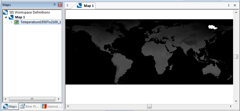
Using the example address shown above in Address of WCS server the following map will be shown: