File-based database
Reads one of the supported database formats directly from a file, e.g. Microsoft Access .mdb/.accdb, or SQLite .db/sqlite.
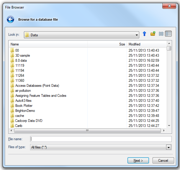
Look in
Shows the hierarchy of folders. Click the adjacent Up arrow to move one folder higher.
Main pane
Lists the folders and files in the selected location.
File name
List the types of files to dipsplay. This is useful for narrowing the displayed list to only the file type you are interested in. The Files of type drop-down list is as follows:
Cadcorp OS MasterMap Database (*.odb)
Microsoft Access 2000 (*.mdb)
Microsoft Access 2007 (*.accdb)
All known formats
All files (".")
Click Next.
The Ordnance Survey (GB) MasterMap - Configuration dialog is displayed:
 MasterMap dialog-OSMM Topo Layer-File based database.png)
OS MasterMap Feature Table
Choose the OS MasterMap Topography table for display.
Geometry Types
Points (incl. Text)
Displays Point Items, including Text.
Line Strings
Displays LineString Items.
Non-bounding only
Displays only 'non-bounding' LineString Items.
Polygons
Displays Polygon Items.
Themes
Choose the OS MasterMap Topographic Themes for display.
Archive View
Create a snapshot view
If active, check the tickbox to create a "snapshot" view of the database, i.e. a historical query at some point in the history of Change-only updates.
Date
The date range for the archive.
Click Finish.