Spatial Analysis
Spatial analysis is a computer-based technique for the investigation and selection of locational entities using their topological, geometric or geographic properties.
Spatial analysis techniques are composed of statistical algorithms, topological functions, and Boolean tests. Spatial analysis processes in Cadcorp SIS Desktop allow for questions such as:
- What is the intersection of two areas?
- How many points are within a given buffer distance?
- What is the probability of an event to occur?
SIS Desktop 9 orders the different spatial analysis methods in groups which are accessible through the analysis tab from the SIS Desktop 9 ribbon interface.
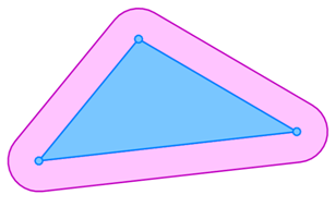
Spatial buffers are newly created geometries based on a buffer distance, a mode, and the geometric shape of the item or group of items which is buffered. The buffer mode defines whether a buffer extends the exterior of the selected geometry, creates an interior, or extends from the boundary geometry. Newly created buffers can be either Polygon or QZone items.
The following example shows an outside mode buffer: