Linear (measure positions along a path)
Linear can measure positions using distances along a path. This command specifies the path along which distances will be measured.
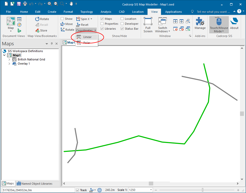
Select View > Axes > Coordinates and select the Linear system. (Group) Linear.png)
This method of measuring positions is sometimes used in applications such as Road maintenance.
Each position can be simply stated using a single number (plus a road name). The approximate position can be simply found by an engineer in the field by using a vehicle's tachometer (sometimes aided by milestones).
After selecting Linear coordinates, enter the path using a series of positions and use Enter to finish.
Future positions will be displayed in the Status Bar.
Example of placing positions at set distances along a path
To place a number of positions along the green LineString Item below:
Go to the View tab and select Coordinates > Linear:
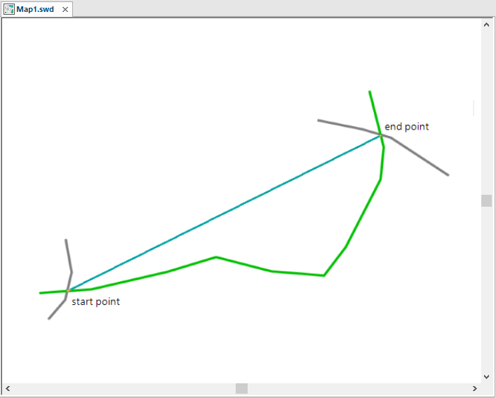
Draw a line from the required start point to the end point. Double click to complete the line.
The line will trace the LineString Item between the start and end points.
TIP: It is not necessary to manually trace the LineString Item along its length.
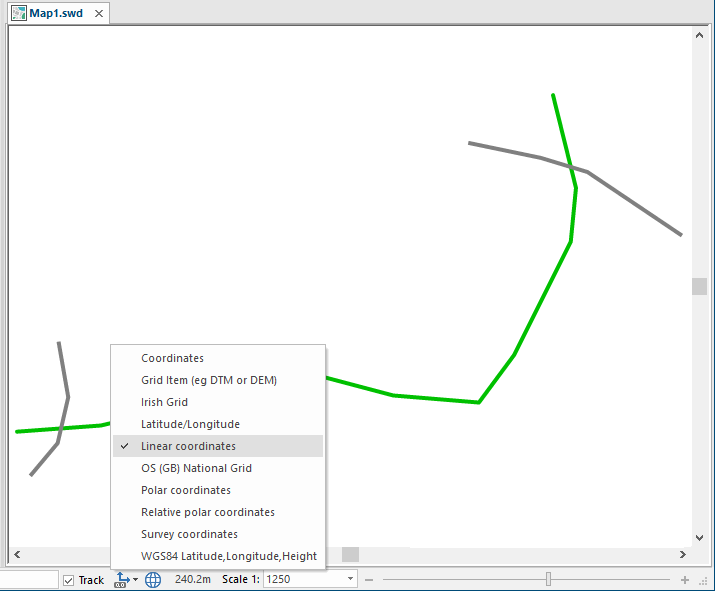
Select Linear coordinates from Coordinates/Axes drop-down in the Status bar:
Go to the Create tab.
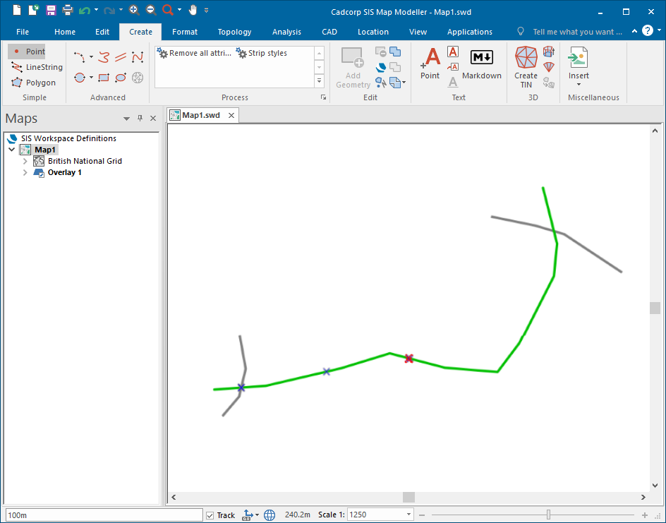
Click on Point (in the Simple group) and place a point at the required start position. The point will show as 0m in the position bar:

Enter 50m in the position bar and press Enter. The second point will be created at a distance of 50m from the start point:
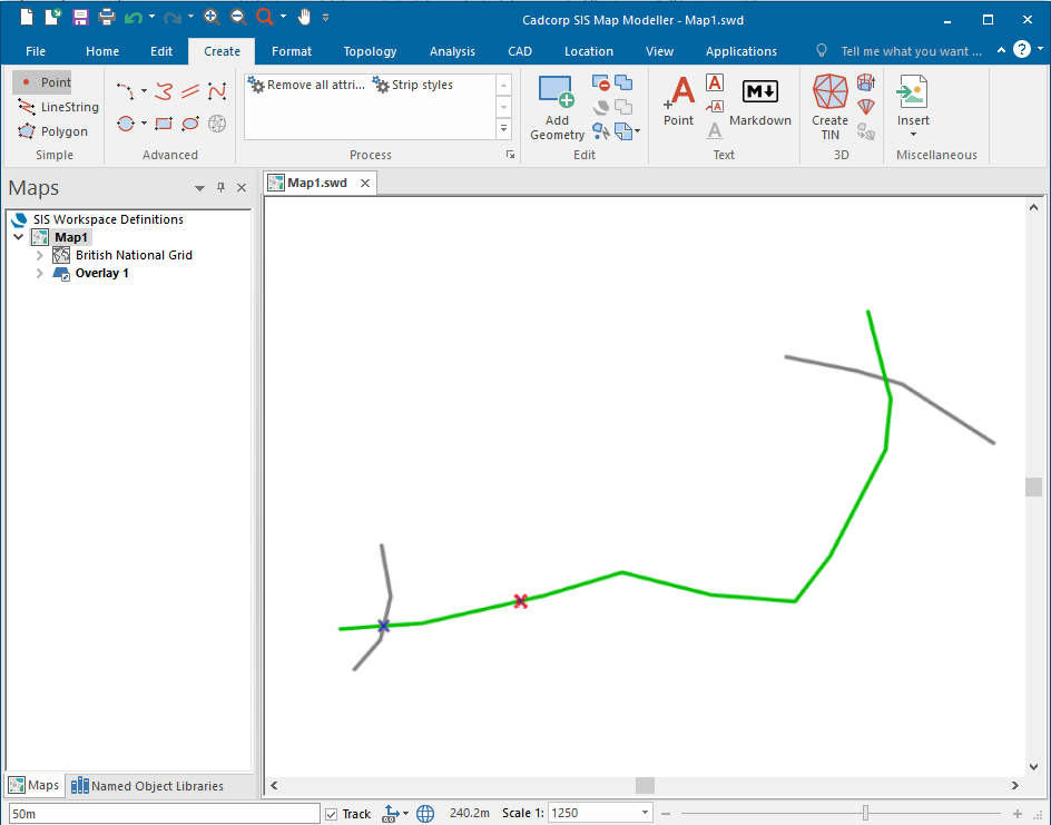
Enter 100m in the position bar and press Enter. The third point will be created at a distance of 100m from the start point:
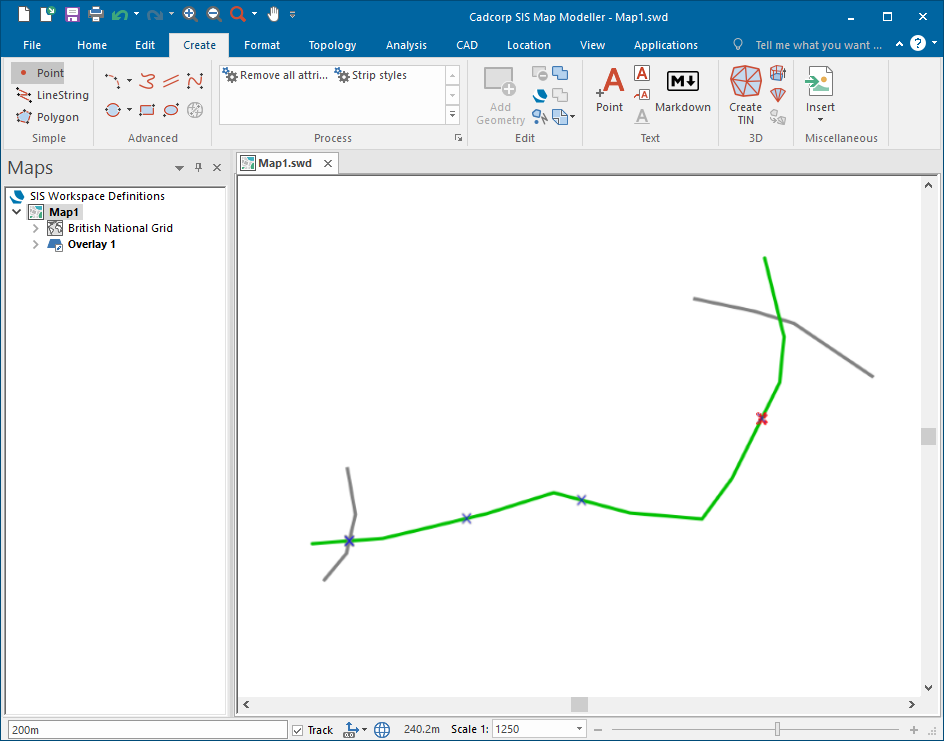
Enter 200m in the position bar and press Enter. The fourth point will be created at a distance of 200m from the start point.
Note: You can only enter a single value for each point, it is not possible to use multiple points at one time, i.e. 100m, 200m, 300m or 100m r 3 will not be recognised.
On completion the coordinate reference system can be returned to the original setting in the Coordinates/Axes drop down.
The images below show a practical use of the Linear command:
The crosses are the start and end points.
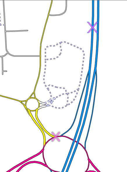
The circle symbols are the set distances from the start point along a road:
