Accessing the SWD
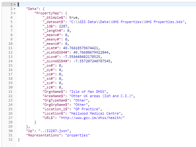
When accessing the properties of a feature or other resources, you will be presented with the most popular properties:
GET http://server:port/geognosis/9/sessions/sessionid/map/overlays/3/items/I2287/properties.json
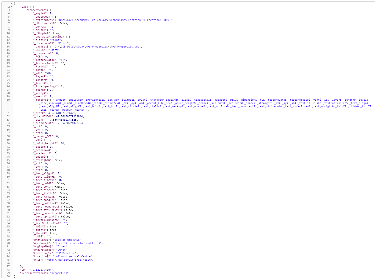
To see ALL of the properties, simply add the ?q=** parameter at the end of the request:
GET http://server:port/geognosis/9/sessions/sessionid/map/overlays/3/items/I2287/properties.json?q=**
The SWD and its properties are accessible through the Map resources and features.
GET http://server:port/geognosis/9/sessions/sessionid/map.json
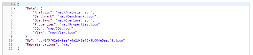
Analysis – provides specific access to Routing and Grid analysis – link to Additional Analysis
Benchmark – allows performance statistics for data loading and drawing to be analysed.
Overlays – access to the data layers stored in the SWD - link to GET to Access items in the SWD
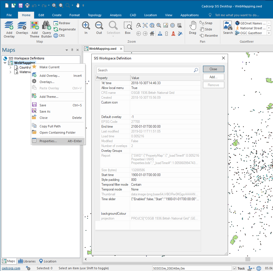
Properties – properties of the SWD can be accessed here (these are the properties displayed by right mouse clicking on the SWD name and selecting ‘Properties’ in SIS Desktop).
SQL – a SQLite representation of the data overlay which can be queried using SQL - link to Additional Analysis
View - displays the Coordinate Reference System information being used for viewing the SWD
GET to access items in the SWD
The HTTP API provides access to all components of the SIS Workspace Definition (SWD). This includes the structure, properties, items and components.
The following GET request will return items in overlay 0 in the SWD. Overlays are numbered from 0 upwards, starting with the first overlay in the SWD.
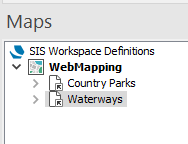
In this SWD, the Country Parks overlay is numbered 0, the Waterways overlay is numbered 1.
To see items in an overlay, use the following request.
GET http://server:port/geognosis/9/sessions/session_id/Map/Overlays/0/items.json
Memory datasets (including internal overlays, .bds file) will return the following format using the itemID:
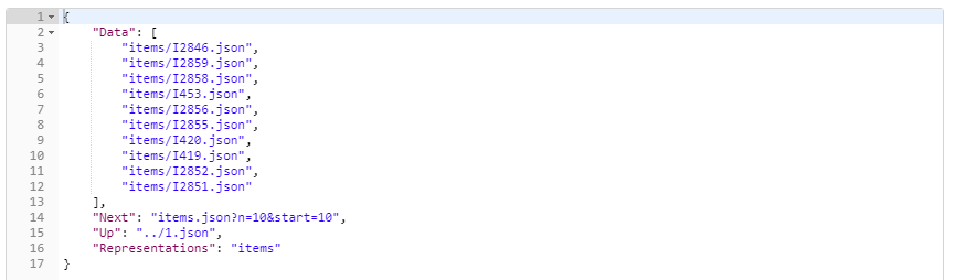
The itemID is generated as the file is read by GeognoSIS so can be used within a session but should not be used as a uniquely identifying property between sessions.
Cursor datasets (including spatial database tables or TAB, SHP, FDB, IDB files) will return items using the following identifying format using the Bookmark:
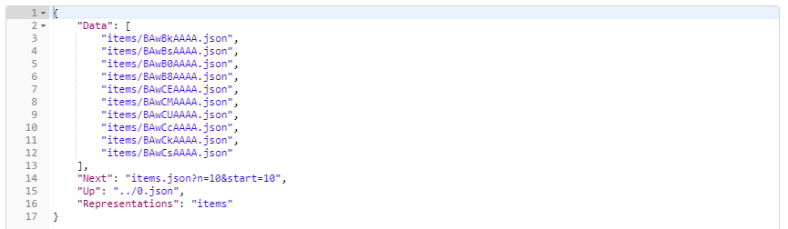
The Bookmark can be used as an identifying feature between sessions if required.
Without additional parameters, this request will return the first 10 items in the overlay.
You can configure the request to return something more specific by adding the number of items to be returned along with the start location. So using the following will return the first 100 items in the overlay:
GET http://server:port/geognosis/9/sessions/sessionid/Map/Overlays/0/items.json?n=100&start=0