Storing Spatial Features in Databases
Benefits of storing Spatial Data in RDBMS Cursor Datasets
- Proprietary spatial storage solutions can be avoided
- Large volumes of data can be stored
- GIS information can be made available throughout the organisation
- Improved management of data:
-
- disaster recovery
- sharing data
- security access
- version control
- disaster recovery
- SQL interface allows relatively open access from GIS and non GIS applications
- Non spatial applications can use the same RDBMS Cursor Dataset tables
- Server side GIS capabilities allows large volume spatial analysis
Supported Databases
SIS Desktop 9 supports the following databases for read and write capabilities using a spatial geometry object:
Oracle (Standard and Enterprise editions)
- Oracle
- Oracle Locator and Spatial (using SDO_Geometry)
- Oracle Network Model
- Oracle Raster
SQL Server (Standard and Enterprise editions)
- SQL Server
- SQL Server Spatial
PostgreSQL
- PostgreSQL using PostGIS
SIS Desktop 9 supports the following databases for read and write capabilities using Cadcorp Editable Geometry (a SIS Desktop 9 controlled multi-user environment for concurrent data editing), BLOB (Binary Large OBject) or OGC SQL92 Dataset:
- Oracle
- SQL Server
- PostgreSQL
- Access
- Any ADO or ODBC compliant database
SIS Desktop 9 supports the following databases for read only access for proprietary or user defined geometry fields:
- Oracle using SDE
- Oracle using view points
- SQL Server using view points
- PostgreSQL/PostGIS using view points
- Any ADO or ODBC compliant database using view points
SIS Desktop 9 has various formats for storing spatial data in any of the databases listed above. Some formats are specific for a particular database, other formats can be stored in any database. Each format is made available for use in SIS Desktop 9 as a dataset.
The Databases tab of the Overlay Types dialog shows the available spatial database types: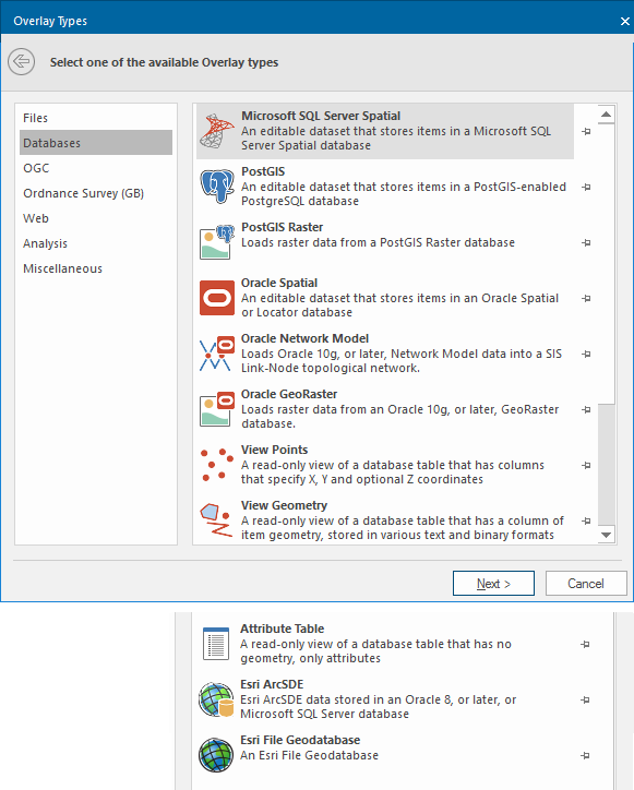
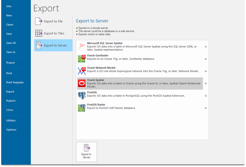
The Export to Server window shows all spatial formats that can be used to export spatial data to databases: