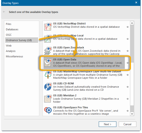
OS OpenData Manager
A dataset that uses OS Open data (OS OpenMap - Local, OS OpenRivers or OS OpenRoads) that can be stored in any of the spatial databases. OS (GB) OpenData will automatically find tables created with this manager and style the data for display and editing.
TIP: To load specific and discrete units of open data as an overlay, you can simply use the Open Data Layer.
Click File > Utilities and select OS OpenData Manager.
This opens the OpenData Loader wizard.
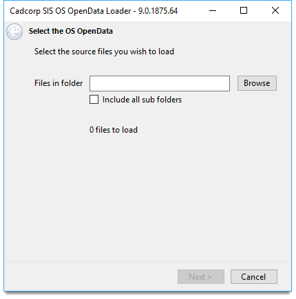
Use the file browser and select the source files to load.
Check the Include all sub folders tickbox if required. The number of files selected for loading will be displayed.
Click Next to select a database.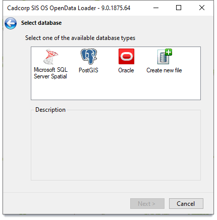
| Option | Description | |
|
Microsoft SQL Server Spatial |
an editable dataset that stores items in a Microsoft SQL Server Spatial database using the planar geometry type. |
|
|
PostGIS |
an editable dataset that stores items in a PostGIS-enabled PostgreSQL database using the PostGIS spatial schema. |
|
|
Oracle |
an editable dataset that stores items in an Oracle 9i, or later Spatial database using the Oracle Object-Relational schema. |
|
|
Create New File |
Create a new Cadcorp Base Dataset (*.bds) or Cadcorp Item Database (*.idb) file |
|
Select the database type and click Next.
The corresponding database login dialog will be displayed.
Example
Here is an example when you select Microsoft SQL Server Spatial database.
You can opt to create a new spatial layer or append to an already existing one listen in the pane.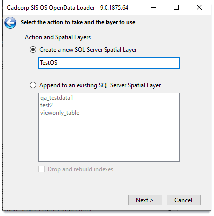
Click Next and press Load to begin the export process.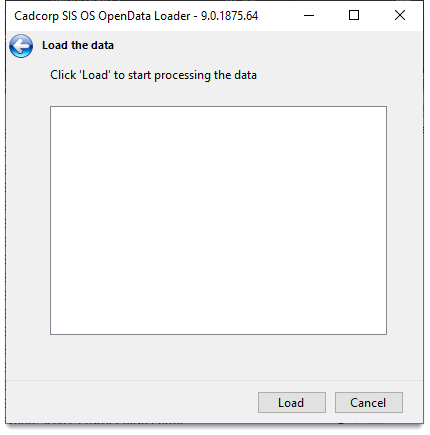
On completion click Close.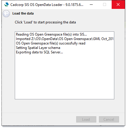
Once the OS OpenData source files have been loaded, you can open the data directly using Add Overlay > Ordnance Survey (GB) > OS (GB) OpenData