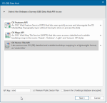
OS (GB) Data Hub

Cadcorp SIS Desktop can now connect directly to the newly released Ordnance Survey Data Hub.
It includes dedicated wizards to easily connect to OS Features API, OS Maps API and OS Vector Tile API 
Both OS Maps API and OS Vector Tile API are available in British National Grid and Web Mercator projections.
- Select Add Overlay > Ordnance Survey (GB) > OS (GB) Data Hub
- Click Next.
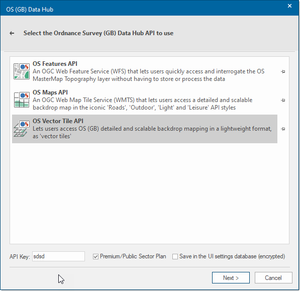
- Select one of the three API options and enter a relevant API key.
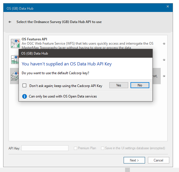
- If you do not have an API key yet, you can use the Cadcorp API Key included as standard. Remember the Cadcorp key is restricted to the free Open Data Plan and cannot be used to access Premium features.

- Enable Premium/Public Sector Plan if you are on the relevant plan.
- Enable Save to save details into the UI settings database.
- Click Next.
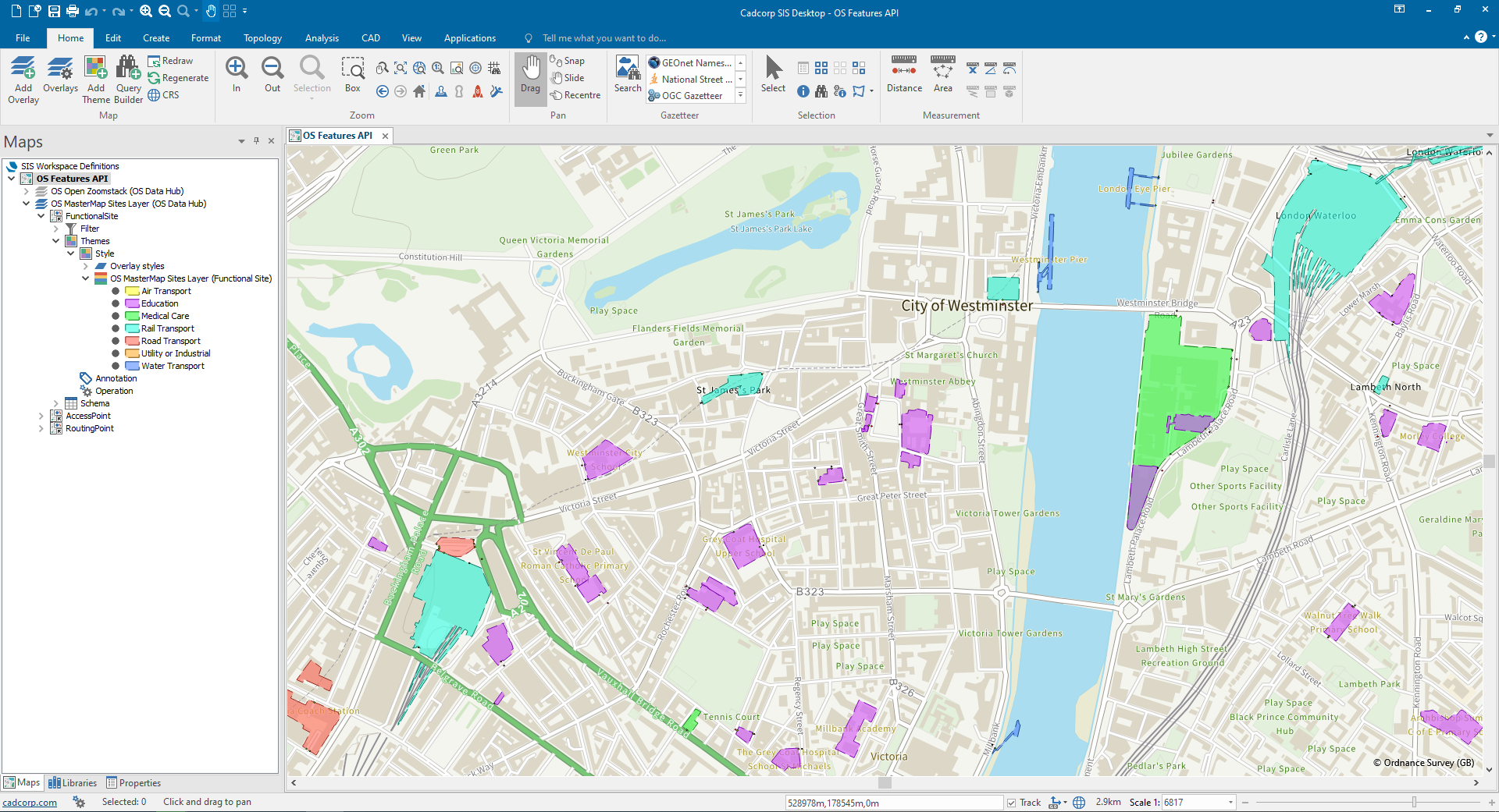
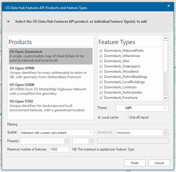
OS Features API
An OGC Web Feature Service (WFS) that lets users quickly access and interrogate the OS MasterMap Topography layer without having to store or process the data.
As this service supplies vector features for download, the user can determine:
- The number of features from each layer that should be downloaded.
- If the download is a one-off import or local cache.
If you cannot see the OS Open UPRN and OS Open USRN Plug-in Geocoders listed, click here.
All features are selected by default. Simply uncheck the feature types that are not required.
Select the style for the map under the Theme option. This option is only applicable to some OS Features API layers.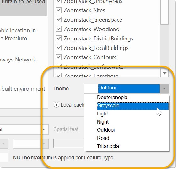
Specify if the download should be a one-off import or a local cache. The selected features will load within the current map extent.
TIP: For best practice, we recommend you limit the maximum number of features.
You can also load features within a specific area of interest. To do this, before launching the Overlay wizard, select the polygon feature on the map for your area of interest.
Follow steps 2 to 9 and then select the ‘Intersect with current item extent’ for the spatial filter. If a different spatial test is preferred, select ‘Spatial test with current item’, and this will activate the spatial test drop-down where you can select your spatial test of choice.
The download is currently restricted to the current map view. (Please check back for updated content and options)
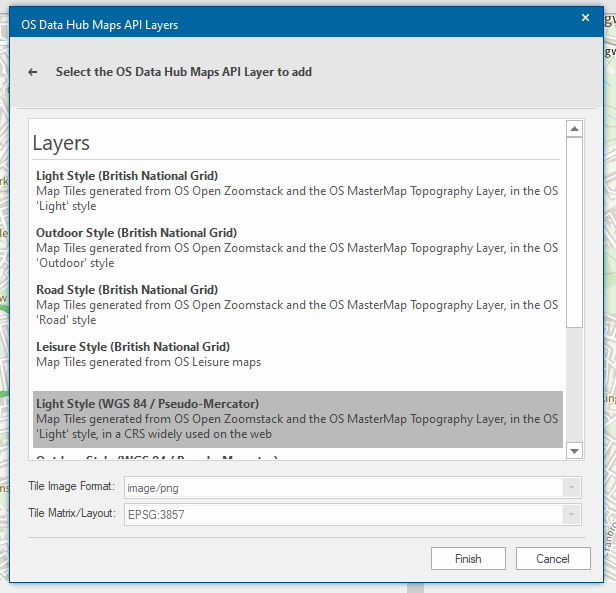
OS Maps API
An OGC Web Map Tile Service (WMTS) that lets users access a detailed and scalable backdrop map in the iconic 'Roads', 'Outdoor', 'Light' and 'Leisure' API styles.
This is ideal for fast background mapping in desktop and web applications.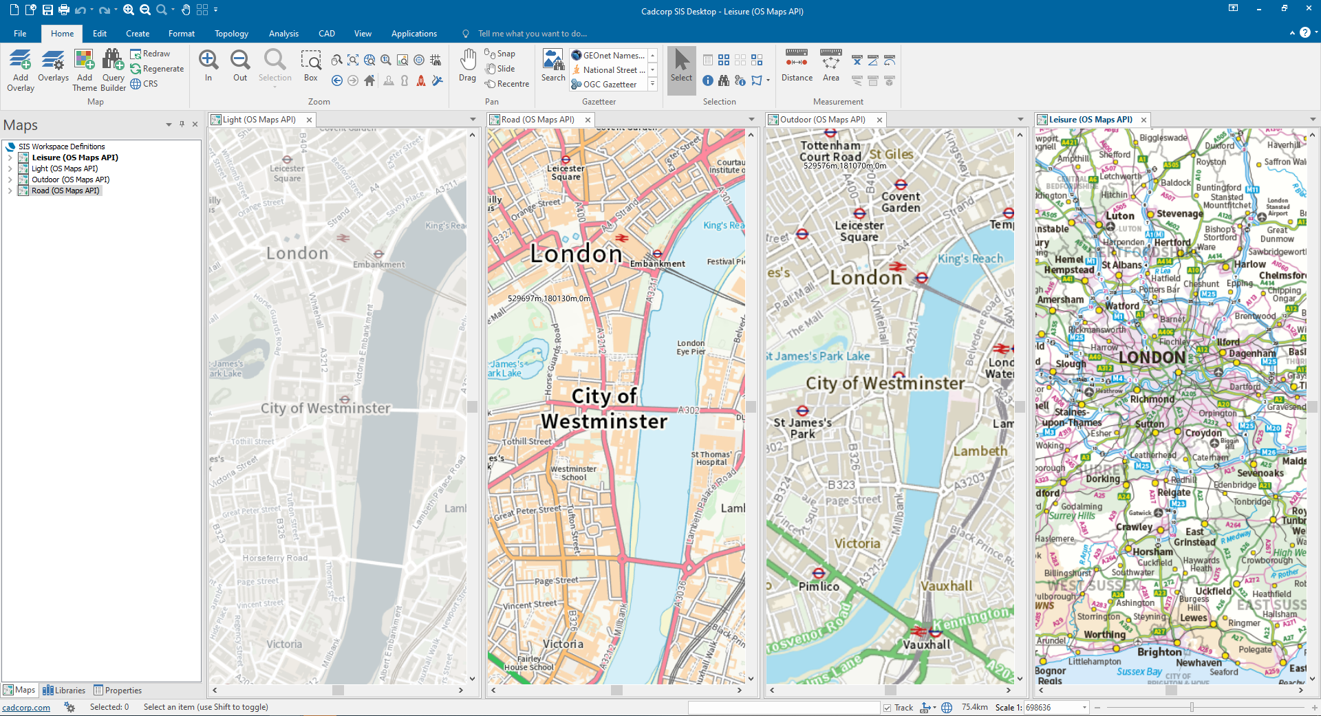
Simply select the appropriate layer and projection from the list of available options.
Note: (Please check back for updated content and options)
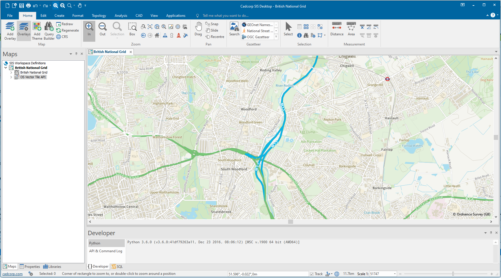
OS Vector Tile API
Lets users access OS (GB) detailed and scalable backdrop mapping in a lightweight format, as 'vector tiles'. This provides the highest quality of mapping at all scales.
Due to its vector format sharp, high quality features are consistently displayed.
Simply select the appropriate tileset and click Finish.
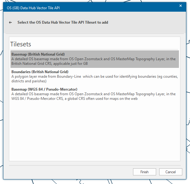
Mapping below scales of 5000 in Vector Tiles is only visible with a Premium Key. Features in Vector Tiles are optimised for display and cannot be selected in SIS Desktop.