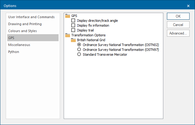
Options- GPS
Click File on the Ribbon and select Options > GPS to customise GPS options.
Note: Desktop Express does not include this tab.
|
Option |
Description | |
|
GPS |
You can control the following GPS information: Display direction/track angle, Display fix information and Display trail |
|
|
Transformation Options |
The datum used for GPS positioning is WGS84 (World Geodetic System 1984). The ellipsoid used in this datum is designed for the best fit of the geodetic datum of the earth as a whole. For greater accuracy within the UK, use one of the following methods to transform data to Ordnance Survey coordinates: British National Grid Ordnance Survey National Transformation (OSTN02) The new and definitive Ordnance Survey transformation and geoid model OSTN02 is an improvement over the previous model, OSTN97. The horizontal transformation accuracy has been improved from 0.05m to 0.02m rms. Ordnance Survey National Transformation (OSTN02) This is an initial transformation with lower accuracy. Standard Transverse Mercator This is the minimum transformation with lower accuracy. |
|