Overlay Status
The status of an overlay governs whether the data on it can be:
- Edited
- Selected but not edited (or)
- Simply viewed.
The status options appear on the General tab of the Overlays dialog and on the overlay’s local menu on the Maps Control Bar:
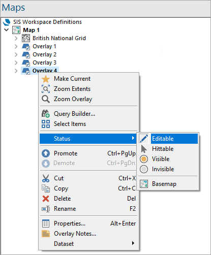
Each overlay can have one of four statuses.
1. Editable
Full access to add, modify and delete information. This option applies only to user datasets (FDB and BDS files, internal datasets and editable geometry overlays).
Only one user at a time can have Editable access to BDS files. These files can however be shared via a network.
Individual item locking is used for editable geometry overlays (which can also be shared via a network).
2. Hittable
Ability to snap the cursor onto graphics to measure, query, trace and copy data. Data cannot be moved, deleted or added.
3. Visible
Graphics appear on screen but cannot be queried (snapped to). The image is purely a background.
4. Invisible
No graphics appear on screen. This is useful for temporarily excluding information from the view.
Basemap
Gives the overlay backdrop status.
Note: See also Basemap (Overlay Status).
Use the Maps Control Bar to change an Overlay’s status. (Simply right-click on the overlay to see this menu).
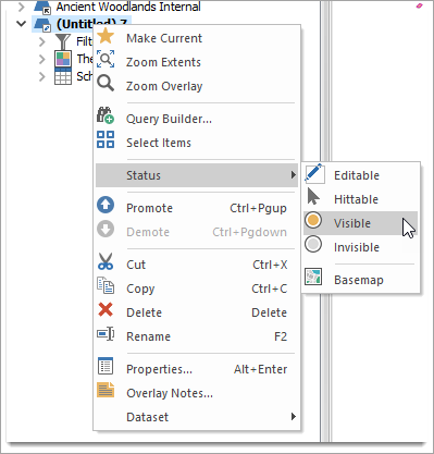
You can also left click on the overlay icon in the Maps Control Bar to toggle its status between its minimum (invisible) and its maximum (set by the user).
User overlays can have any status. However, in the case of shareable BDS files, only one user may have editable access at any one time. Other users will find access limited to hittable until the first user releases ownership.
External datasets such as Ordnance Survey NTF cannot be edited (unless a copy has been made by using the Imported File option) and therefore can only have a maximum status of hittable.