MapInfo Interchange (*.mif)
Export as an ASCII MapInfo Data Interchange Format (MIF), comprised of two files – geometry graphics file (*.mif) and attributes (*.mid). Styles are maintained through export. Gives the option to change field names and length of character fields.
When exporting to MapInfo Interchange (*.mif) the following MapInfo Exporter dialog is displayed:
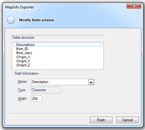
The MapInfo Exporter dialog allows you to specify the table structure and field information.
Arguments to Export API Method
- clsExport$
AMapInfoExporter
- params$
[index=nOverlay,][width=nWidth]
index
The position in the overlays list of the overlay to export. The default value is0.
width
The width of MID file "char" columns. The default value is30.
Compatibility:
- Cadcorp SIS Desktop
- Cadcorp SIS ActiveX Modeller
- Cadcorp SIS ActiveX Manager
- Cadcorp SIS ActiveX Viewer
- Cadcorp GeognoSIS
