Map Features
Map features displays all supported data layers from GeognoSIS SWD, WMS or WFS.
Use Map Features to:
- Expand and collapse groups
- Turn data layers on and off
- View legend and metadata for each layer.
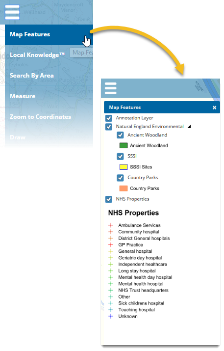
Click on the check box next to each layer to turn visibility on/off.
More Mapping
You can add even more mapping layers to view, if you require.
- Click More Mapping.
- Choose the layer(s) you want by clicking the check box.
- Click Add to include your layers in the main Map Features window.
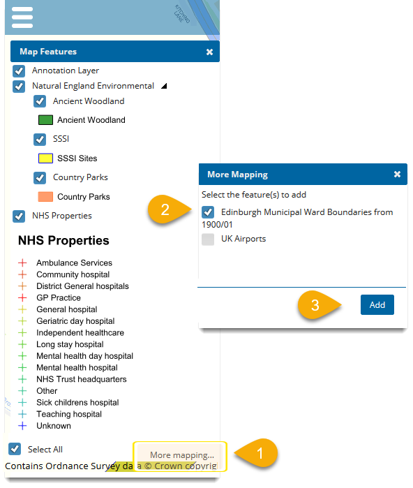
Layers added using More Mapping will be remembered using cookies and will be reloaded when you start SIS WebMap again.
Note: Remove INDIVIDUAL More Mapping layers using the cross displayed next to each layer. Remove ALL layers using Settings > Clear all user created layers.