Metadata
Metadata is information ‘about’ other data or layers. Metadata is only supported for GeognoSIS SWD, WMS and WFS layer types.
Adding metadata
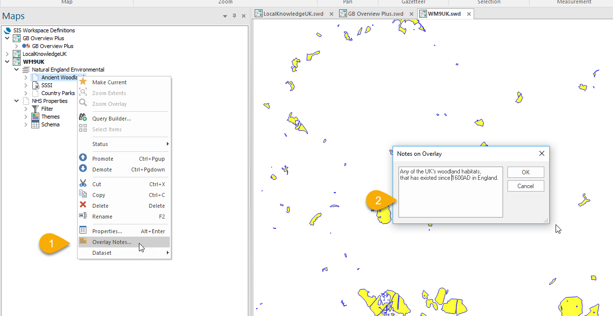
Open the SWD in CadcorpSIS Desktop.
- Select the layer and right-click to choose Overlay Notes.
- Type the metadata in the text box and click OK.
- Save the SWD.

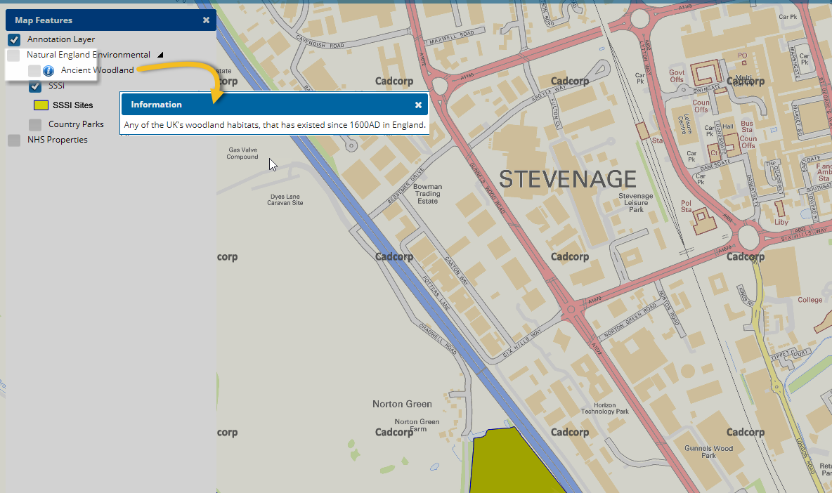
- Now open WebMap and click on Map Features (Refresh the browser if already open)
- Click on the blue “i” button to view the added metadata.
