Geospatial Data Abstraction Library (GDAL)
Loads data via the Geospatial Data Abstraction Library (GDAL).
The Geospatial Data Abstraction Library (GDAL) is a library for reading and writing raster geospatial data formats, it is released under licence by the Open Source Geospatial Foundation. (http://www.osgeo.org/) 
GDAL is used by SIS Desktop 9.1 for the majority of raster geospatial data formats. See http://www.gdal.org/ for more information.
Select Home > Add Overlay > Miscellaneous > GDAL and click Finish.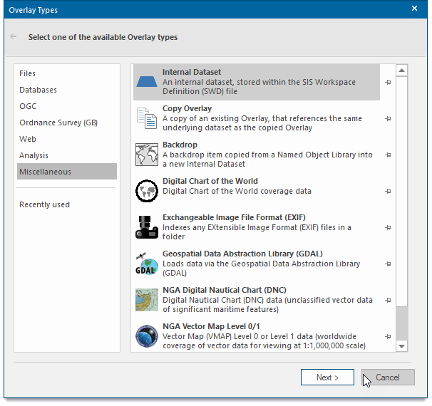
This opens the Geospatial Data Abstraction Library: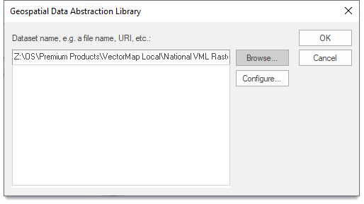
Browse for the file name, URI, etc.
Browse to the required file and click OK.