NGA Vector Map Level 0/1
Loads VMAP Level 0/1 data.
Select Home > Add Overlay > Miscellaneous > GDAL and click Finish.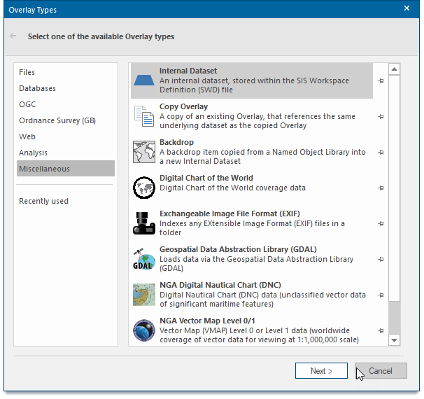
This opens the options window:.![]()
| Option | Description | |
|
Source Coverage |
Browse to the folder from which to load the coverage. Also select the Coverage(s) from the list of available coverages. |
|
|
Source Extents |
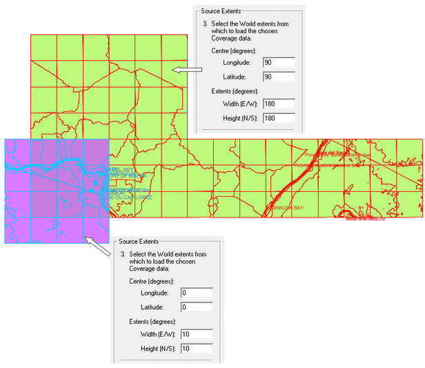
Centre (degrees) Longitude - in the range -90 to 90 or -180 to 180. Centre (degrees) Latitude - in the range -90 to 90 or -180 to 180. Extents (degrees) Width (E/W)/Height (N/S) - in the range 1 to 360. |
|
|
Gazetteer |
If the Gazetteer button is active information can be used to specify the source extents. |
|
Example:
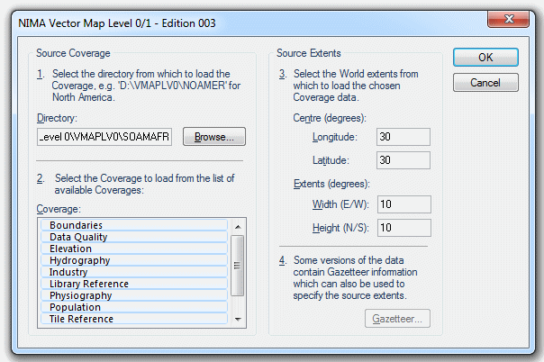
Browse to the folder from which to load the source coverage, select the required Coverage(s), enter the source extents and click OK.
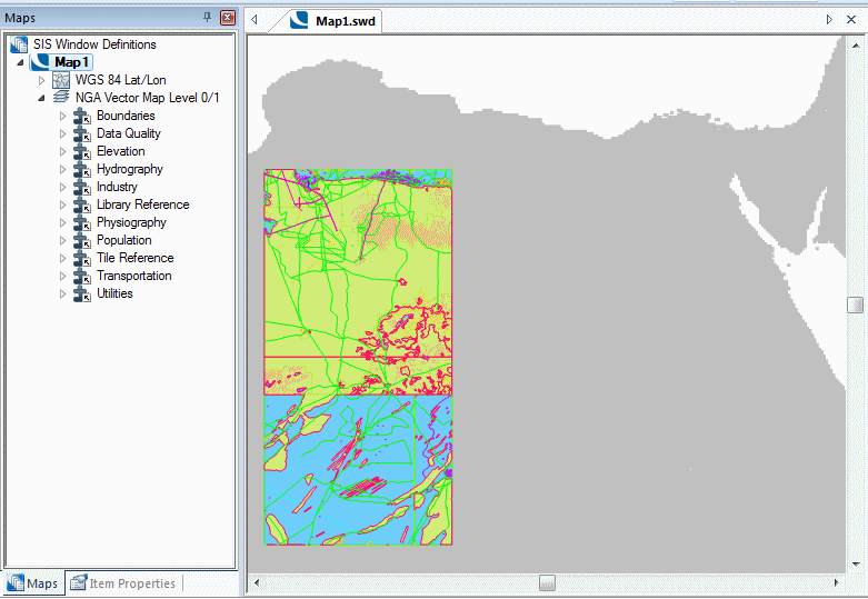
This example displays the following:
Example of the results that may be obtained with different Source Extents settings: