OGC API- Maps
The OGC API - Maps Standard helps you construct an API that can serve spatially referenced electronic maps. More information is available on the OGC API- Maps page here 
Options are available inside a GeognoSIS instance to :
- Grant privileges
- View the map being used by the service
- Access API documentation
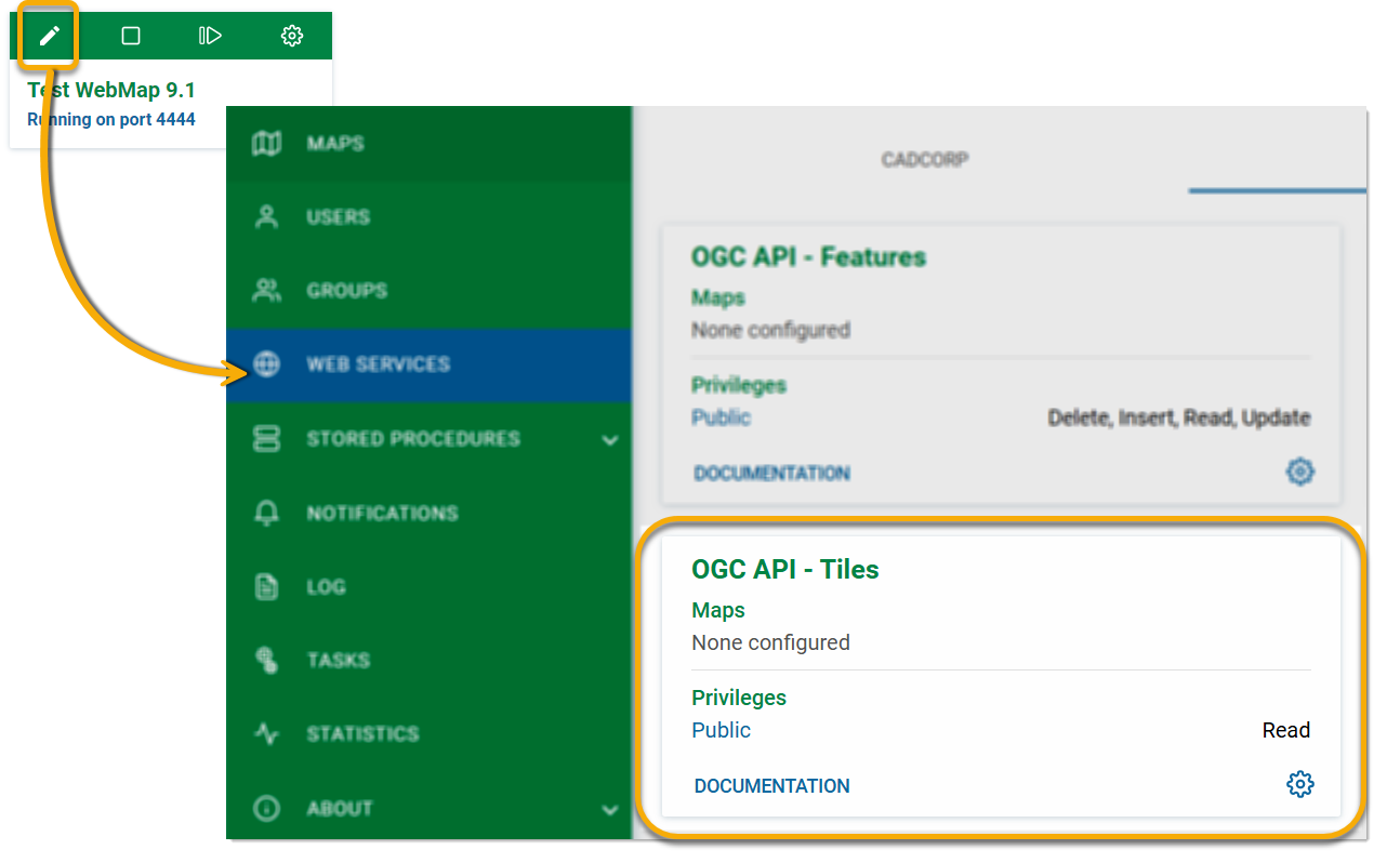
Click Edit on an instance and select Web Services > OGC > OGC API- Maps.
Options
To define API privileges, click Options ![]() > Privileges. Because Maps are image-based, you can only read the content. Select desired users/groups from the drop-down menu.
> Privileges. Because Maps are image-based, you can only read the content. Select desired users/groups from the drop-down menu.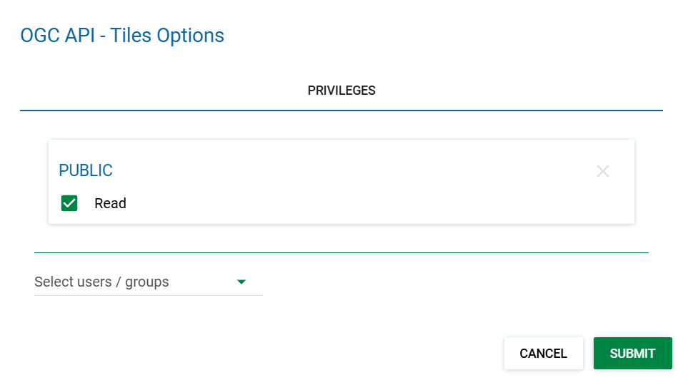
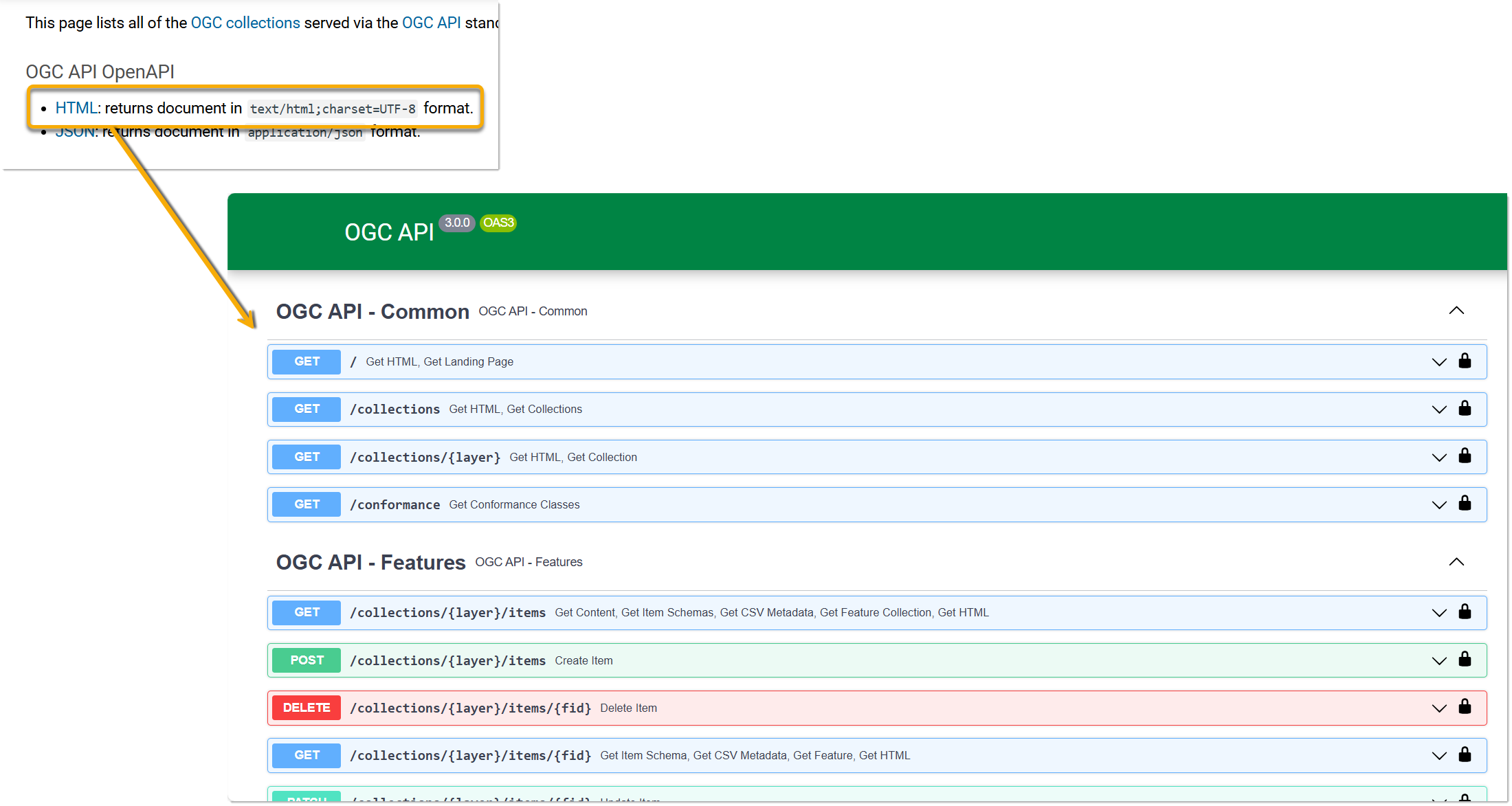
Click Documentation to view API documentation.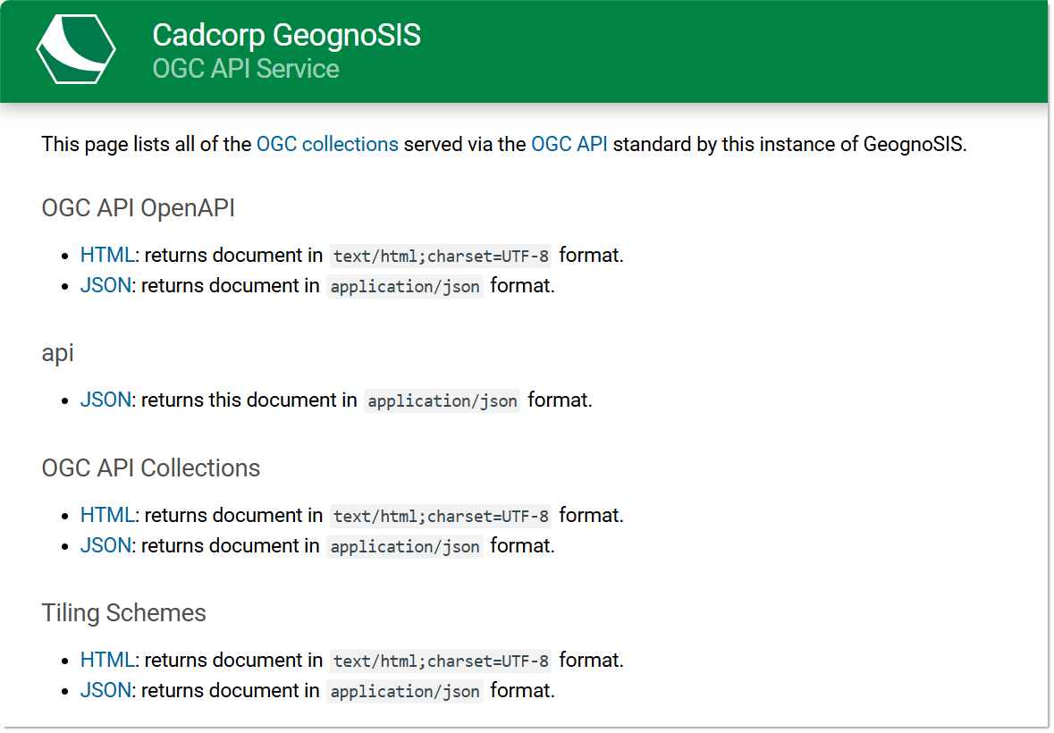
To try out the various API methods, click the first link HTML on the documentation page. This will direct you to a page where you can try API methods that are common to all three OGC API types: Features, Maps and Tiles.