OGC API- Tiles
The OGC API — Tiles standard helps you create Web APIs that can retrieve geospatial information as tiles. Different forms of geospatial information are supported, such as tiles of vector features (“vector tiles”), coverages, maps (or imagery) etc.
More information is available on the OGC API- Tiles page here 
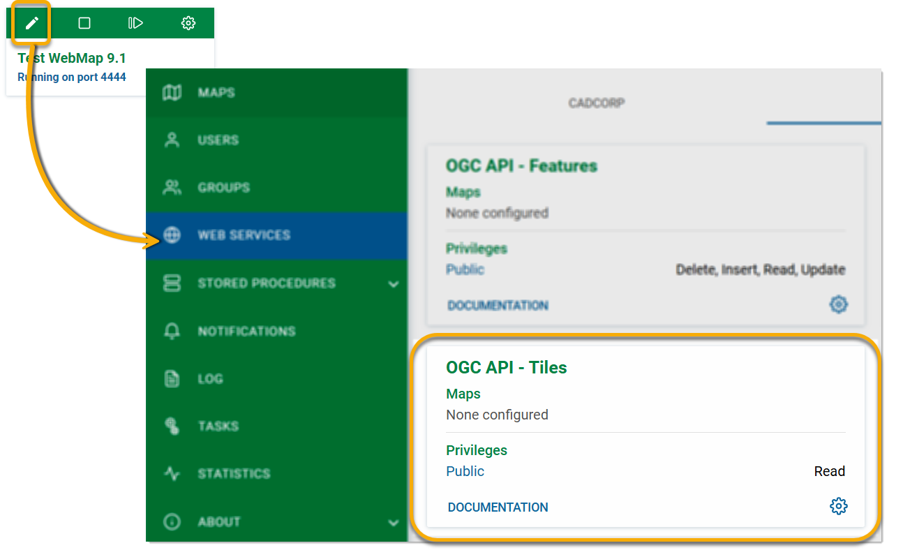
Options are available inside a GeognoSIS instance to :
- Grant privileges
- View the map being used by the service
- Access API documentation
Click Edit on an instance and select Web Services > OGC > OGC API- Tiles.
Options
To define API privileges, click Options ![]() > Privileges. Because Tiles are image-based, you can only read the content. Select desired users/groups from the drop-down menu.
> Privileges. Because Tiles are image-based, you can only read the content. Select desired users/groups from the drop-down menu.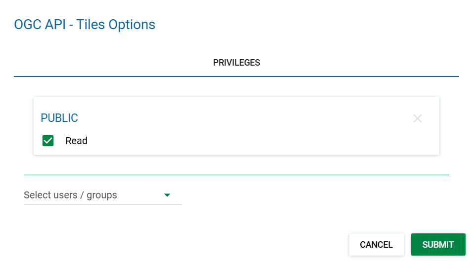
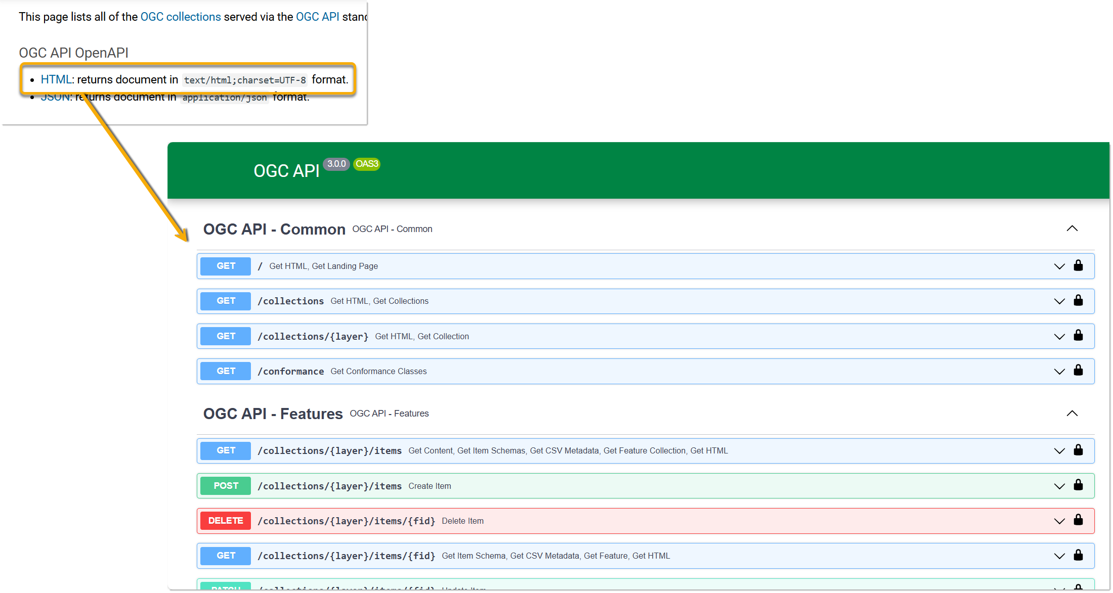
Click Documentation to view API documentation.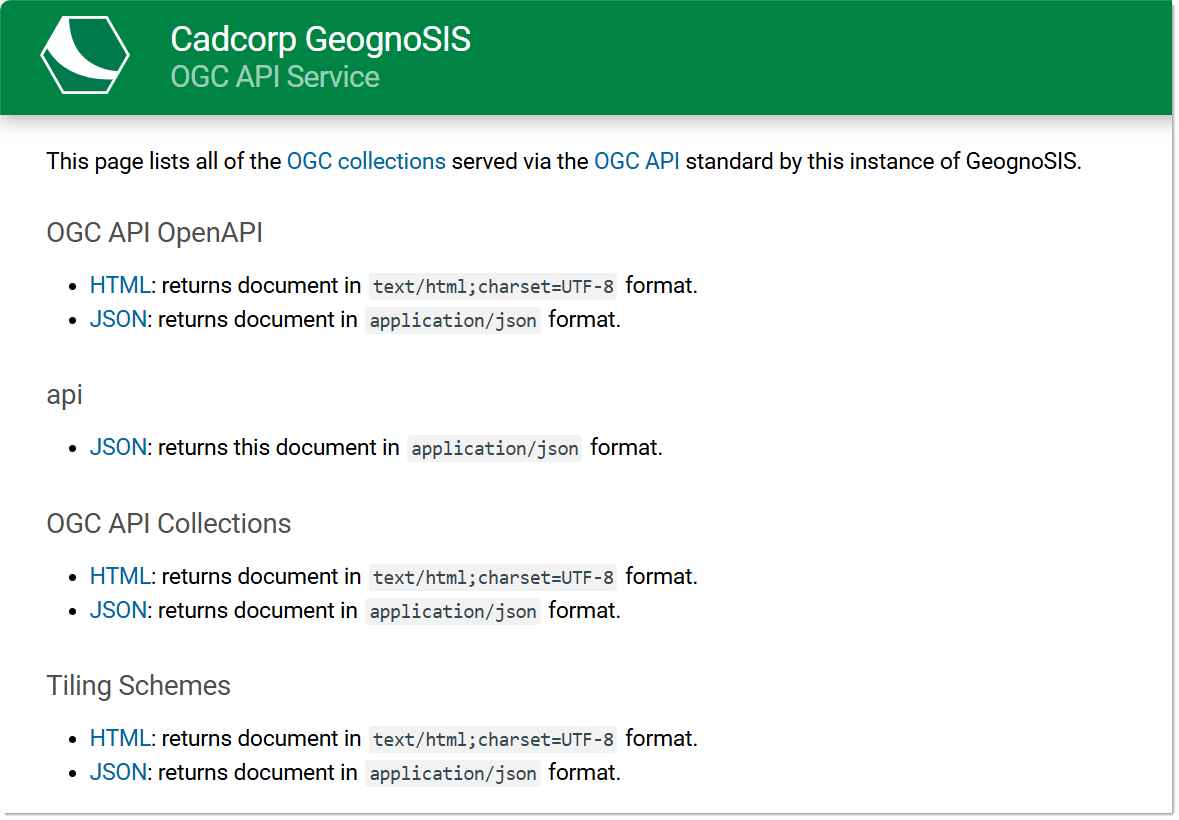
To try out the various API methods, click the first link HTML on the documentation page. This will direct you to a page where you can try API methods that are common to all three OGC API types: Features, Maps and Tiles.