OS (GB) Data Hub
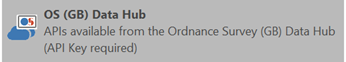
Cadcorp SIS Desktop can now connect directly to the newly released Ordnance Survey Data Hub.
It includes dedicated wizards to easily connect to OS NGD API, OS Features API, OS Maps API and OS Vector Tile API 
Both OS Maps API and OS Vector Tile API are available in British National Grid and Web Mercator projections.
- Zoom to an area of interest in one of your existing SWDs, or try using the ribbon bar search to zoom to a postcode matched against the OS Names API.
- Select Add Overlay > Ordnance Survey (GB) > OS (GB) Data Hub
- Click Next.
- Select one of the API options and enter a relevant API key.
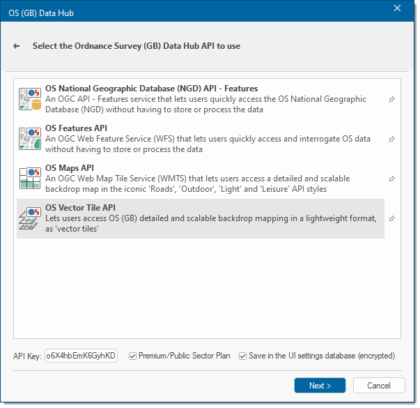
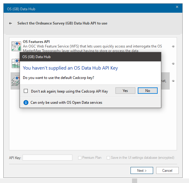
- If you do not have an API key yet, you can use the Cadcorp API Key included as standard. Remember the Cadcorp key is restricted to the free Open Data Plan and cannot be used to access Premium features.
- Enable Premium/Public Sector Plan if you are on the relevant plan.
- Enable Save to save details into the UI settings database.
- Click Next.
The download is currently restricted to the current map view. (Please check back for updated content and options)
Data Hub options
- OS National Geographic Database (NGD) API- Features
- OS National Geographic Database (NGD) API- Tiles
- OS Features API
- OS Maps API
- OS Vector Tile API
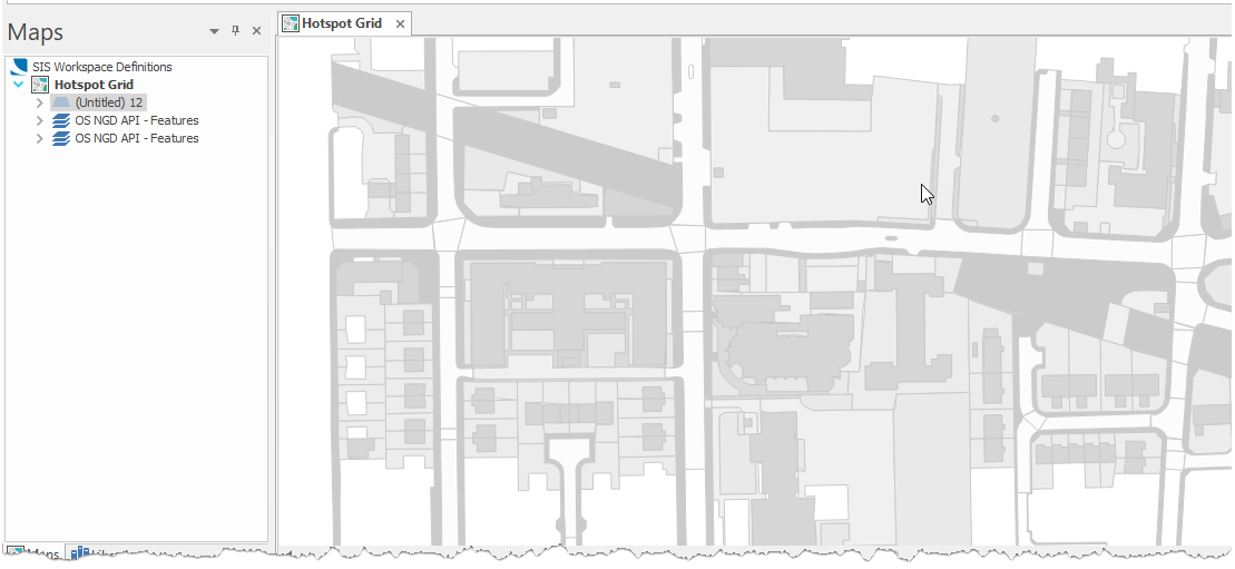
OS NGD API- Features
Gives you simple and quick access to the OS National Geographic Database (OS NGD). Use this feature to filter by attribute, location and time to create your own customised data selections.
The data consists of "themes" of related items: Buildings, Geographical Names, Land, Land Use, Structures, Transport, and Water. Each theme in turn contains one or more “collections”, eg the Water theme contains both the Water Features and Water Network collections.
Each collection is further broken down to the most granular level feature types: these are objects grouped by geometry or classification.
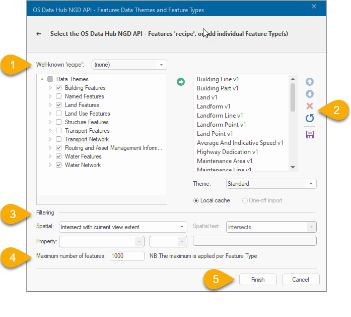
- Begin by selecting Features in the tree of themes and their associated feature types. Click the Add arrow
 to include them to your selection. The Well-known Recipe dropdown helps you to quickly select useful presets (including “Contextual”, which will resemble the appearance of the OS MasterMap topographic area layer).
 - Use the editing tools to delete one or all feature types or to re-arrange the order in which they are displayed on your SWD.Support for One-off imports and local caches may be added later.
- Use the Filtering options (especially the maximum number of features limit) to define how much data is required for display. Be aware of the following:
- If a Spatial filter is not set, data for the whole of the UK will be requested (limited by the maximum number of features value.) The returned features are not guaranteed to be close together.
- Property filters are available for a single feature. Filters cannot be used for multiple feature types; instead the most common properties are automatically loaded.
- Use the Intersect with current view extent option to only request features (up to the maximum number of features value) that overlap the currently displayed map extents.
- You can also load features within a specific area of interest. To do this, select a polygon feature on the map for your area of interest BEFORE opening the Overlay wizard. This will automatically add the “Spatial test with current item” spatial filter option.
- Be cautious when setting the maximum number of features to be requested. For best practice, we recommend you limit the maximum number of features and apply a spatial filter until you have identified a good balance between performance and usability.
- Click Finish to request the selected features using the specified filter(s).
SIS Desktop does not save the returned features themselves in the SWD, but instead will re-request them from the NGD API – Features when the SWD is re-opened. This ensures you have up-to-date data available at all times.
![]()
OS National Geographic Database (NGD) API- Tiles
An OGC API - Tiles service powered by the OS National Geographic Database (NGD) providing a detailed basemap and other backdrop tiles. This overlay supports most NGD features including recently-released ones like Railway Links, Pavements and Buildings.
![]()
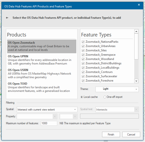
OS Features API
An OGC Web Feature Service (WFS) that lets users quickly access and interrogate the OS MasterMap Topography layer without having to store or process the data.
As this service supplies vector features for download, the user can determine:
- The number of features from each layer that should be downloaded.
- If the download is a one-off import or local cache.
If you cannot see the OS Open UPRN and OS Open USRN Plug-in Geocoders listed, click here.
All features are selected by default. Simply uncheck the feature types that are not required.
Select the style for the map under the Theme option. This option is only applicable to some OS Features API layers.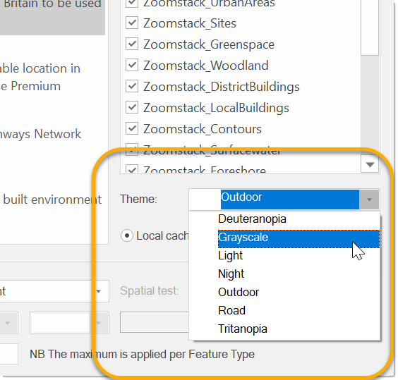
Specify if the download should be a one-off import or a local cache. The selected features will load within the current map extent.
For best practice, we recommend you limit the maximum number of features.
You can also load features within a specific area of interest. To do this, before launching the Overlay wizard, select the polygon feature on the map for your area of interest.
Follow steps 2 to 9 and then select the ‘Intersect with current item extent’ for the spatial filter. If a different spatial test is preferred, select ‘Spatial test with current item’, and this will activate the spatial test drop-down where you can select your spatial test of choice.
![]()
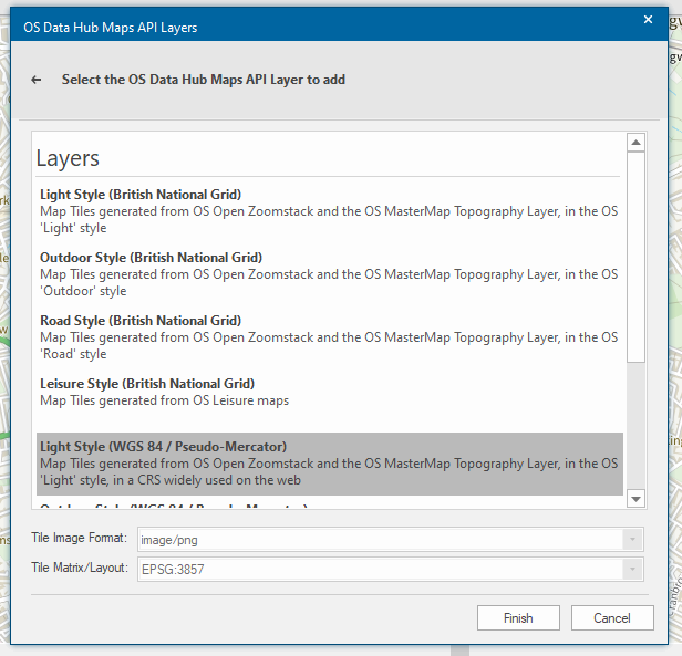
OS Maps API
An OGC Web Map Tile Service (WMTS) that lets users access a detailed and scalable backdrop map in the iconic 'Roads', 'Outdoor', 'Light' and 'Leisure' API styles.
This is ideal for fast background mapping in desktop and web applications.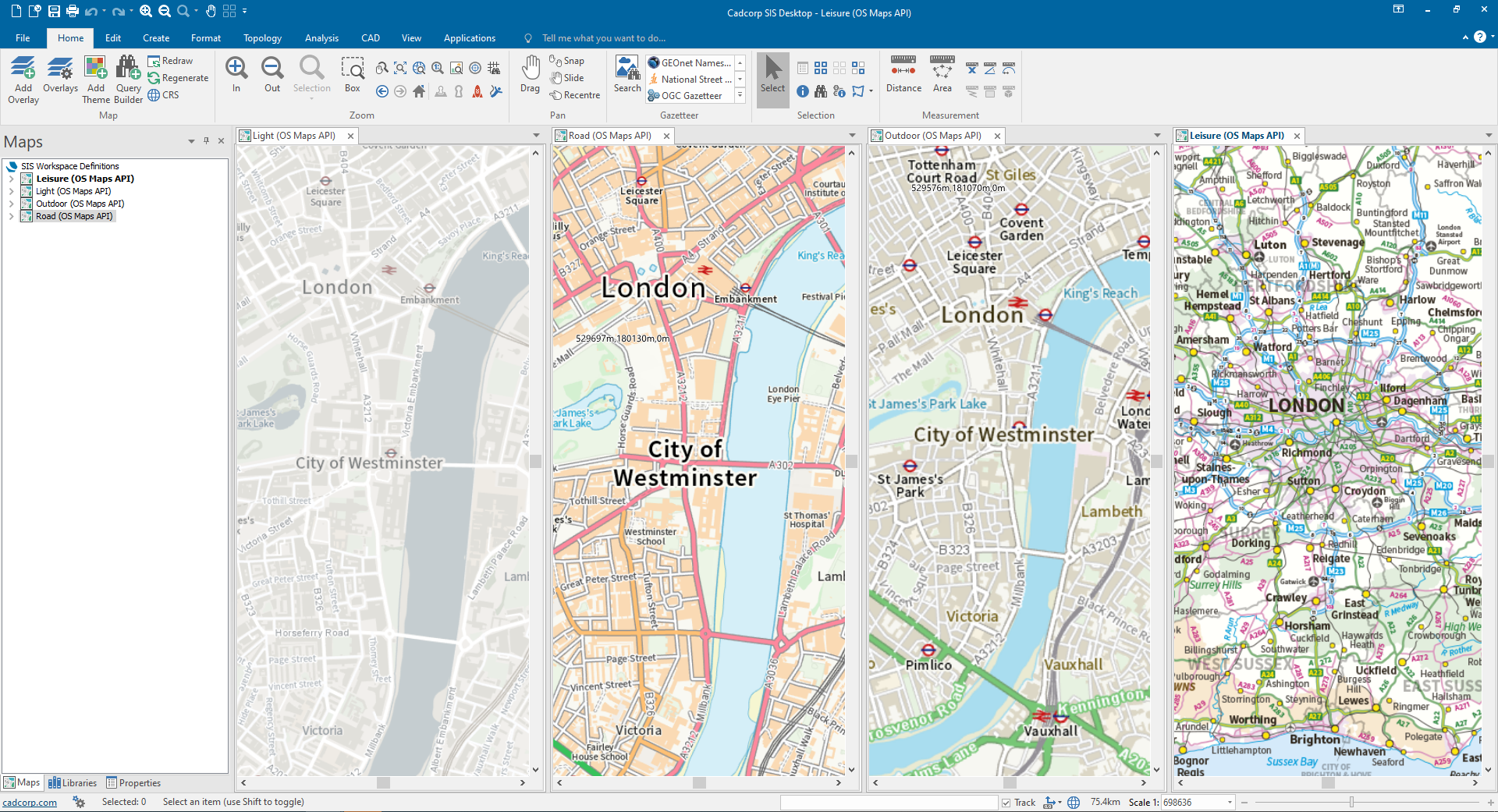
Simply select the appropriate layer and projection from the list of available options.
Note: (Please check back for updated content and options)
![]()
OS Vector Tile API
Lets users access OS (GB) detailed and scalable backdrop mapping in a lightweight format, as 'vector tiles'. This provides the highest quality of mapping at all scales.
Due to its vector format sharp, high quality features are consistently displayed.
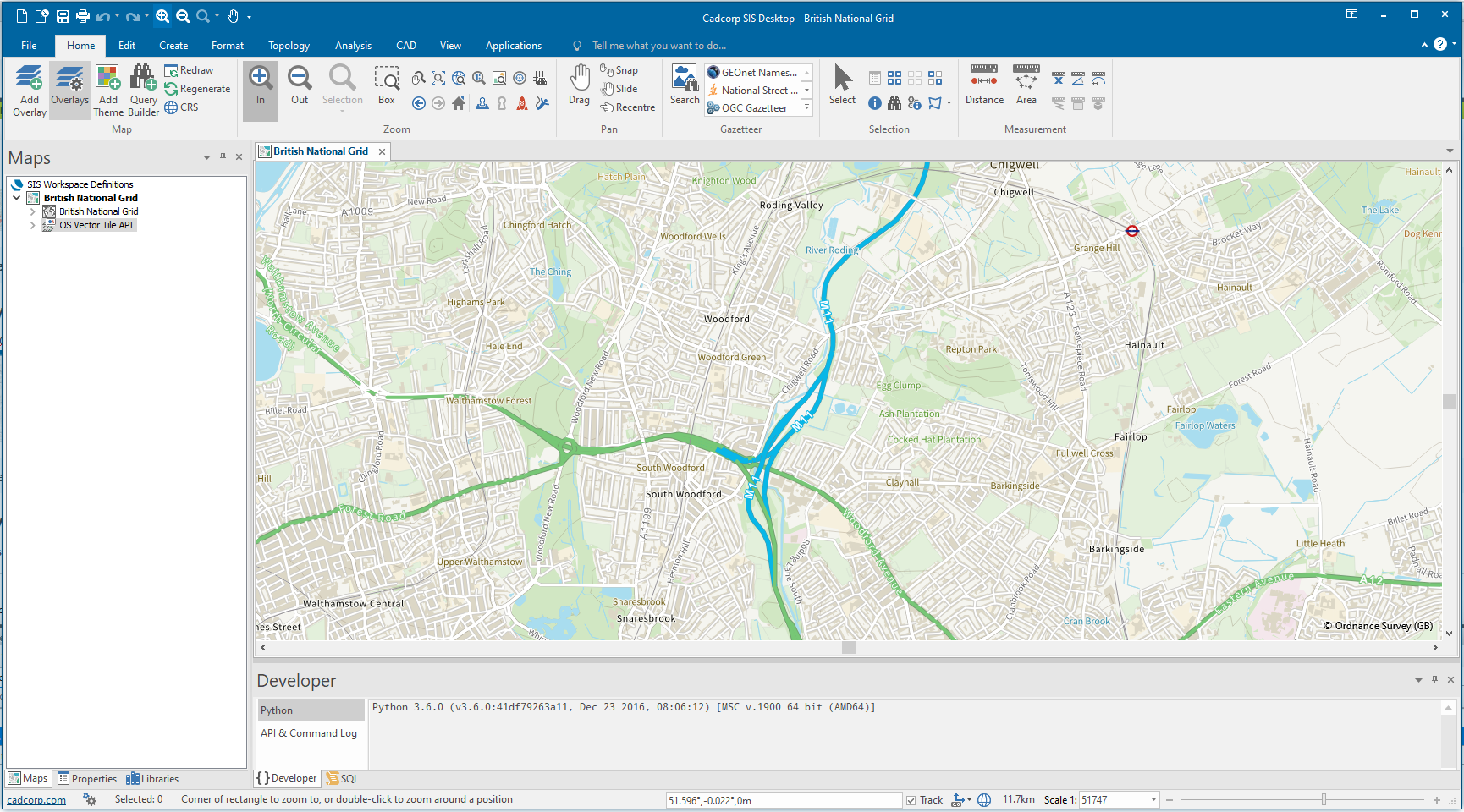
Simply select the appropriate tileset and click Finish.
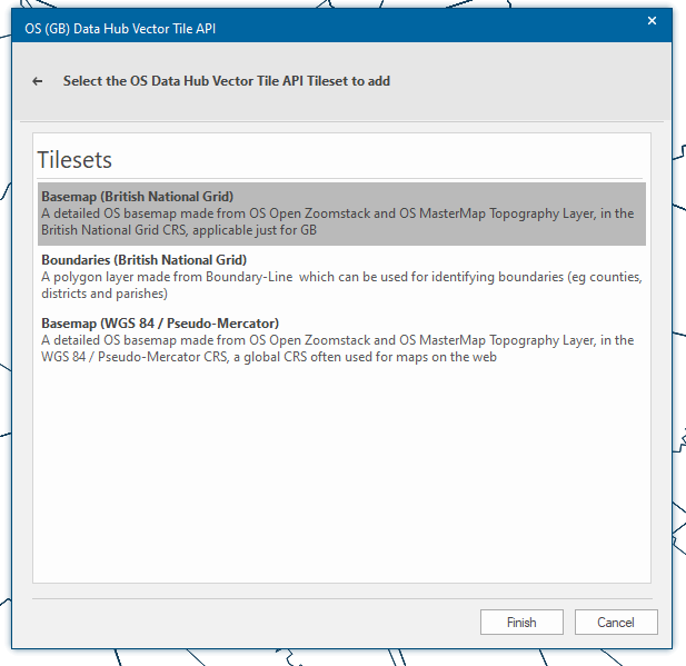
Mapping below scales of 5000 in Vector Tiles is only visible with a Premium Key. Features in Vector Tiles are optimised for display and cannot be selected in SIS Desktop.
![]()