Manage CRS
CRS stands for Coordinate Reference Systems. WebMap uses CRS to specify display projections for individual layers. It does this by utilizing unique SRIDs (spatial reference identifiers) from EPSG. The SRID is typically a numerical code that specifies all related display projections, bounding coordinates etc.
Add a new Coordinate Reference System
To add a Coordinate Reference System, first obtain the EPSG code of the area from https://epsg.io/ 
This will also give you the bounding points (minimum and maximum X and Y coordinates).
Note: EPSG is a globally recognised dataset of coordinate references. SIS WebMap 9.1 comes pre-loaded with these popular EPSG codes.
Here are some commonly used EPSG codes.
| 27700 | British National Grid |
| 4326 | World |
| 3857 | World (used in rendering map tiles for Bing and Google Maps) |
| 3095 | Japan |
| 25832 | Europe |
| 31466 | Germany (Gauss-Krüger zone 2) |
|
31467 |
Germany (Gauss-Krüger zone 3) |
| 7856 | Australia GDA2020 |
Select CRS from the quick-access menu.
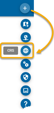
Click New Item to add a new code.
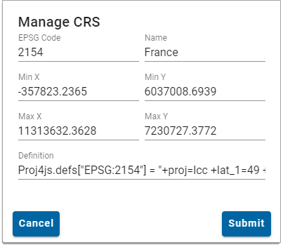
- Enter the code and name for the CRS.
- Include the Min X/Y and Max X/Y coordinates. These extents are the projected bounds as specified in epsg.io (some experimentation may be required if the data does not align).
- Enter the definition for the new CRS. (This definition is available to copy from the PROJ.4 section of the relevant EPSG page).
- Click Save.
Manage a Coordinate Reference System
Click Edit![]() to change details for the Coordinate Reference System.
to change details for the Coordinate Reference System.
Click Remove ![]() to delete a Coordinate Reference System.
to delete a Coordinate Reference System.
Use Search to look for a defined Coordinate Reference System.
You can only delete reference systems you have added. Pre-loaded CRS cannot be deleted.