Open Street Map (OSM)
OpenStreetMap (OSM) is a collaborative project aimed at creating and providing free geographic data. This data can be included in WebMap for use in base mapping.
You can choose from a number of compatible products like CyclOSM, Transport, Tracetrack Topo etc to render data as a Slippy Map 
Note: You can also create your own cache of OSM mapping tiles from regular dumps of the whole OSM database at http://planet.openstreetmap.org/
Adding the data
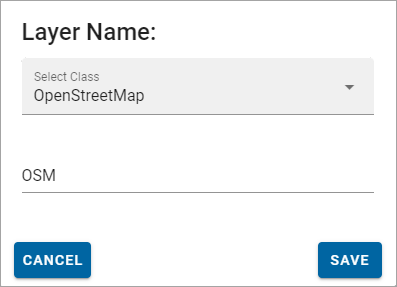
To create an OSM layer, select Configuration > Layers > Add Overlay on the map.
Select Open Street Map from the drop-down menu and enter a descriptive name.
Click Save.
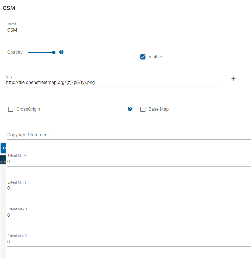
| Field | Description |
| Name | Enter a name that is descriptive of the layer. |
| Add URL | The URL to the OSM tile server; this will be different depending on the type of OSM base mapping you add. Multiple URLs can be added to allow concurrent requests to be made to the server. For more details, see table below. |
| Opacity | Increase or decrease the opacity of the layer. |
| Visible | Tick this checkbox for data to appear on the map and in the Map Features dialog. |
| Cross Origin | Tick this option to allow Cross Origin Resource requests (CORS service), for example if the SWD is referencing an external database or using web services to access data |
| Base Map | All layers added are assumed to be a data layers unless this box is ticked. |
| Copyright | Copyright text entered here will appear across the bottom left of your WebMap site. |
| Extent Min X and Min Y | Minimum bounding extent on X axis for layer rendering. i.e. bottom left hand corner of a rectangle outside of which data will not be rendered. |
| Extent Max X and Max Y | Maximum bounding extent on Y axis for layer rendering i.e. top right hand corner of a rectangle outside of which data will not be rendered. |
Required URLs
To add the tiles as a Slippy Map the appropriate URL needs to be passed to WebMap (see table below for examples). To increase the map’s render speed, use multiple URLs to make concurrent requests.
| Product Name | URL | Zoom Levels |
| OSM 'standard' style | https://tile.openstreetmap.org/zoom/x/y.png | 0-19 |
| OpenCycleMap | http://[abc].tile.thunderforest.com/cycle/zoom/x/y.png | 0-22 |
| Thunderforest Transport | http:/ [abc].tile.thunderforest.com/transport/zoom/x/y.png | 0-22 |
| MapTiles API Standard | https://maptiles.p.rapidapi.com/local/osm/v1/zoom/x/y.png?rapidapi-key=YOUR-KEY | 0-19 globally |
| MapTiles API English | https://maptiles.p.rapidapi.com/en/map/v1/zoom/x/y.png?rapidapi-key=YOUR-KEY | 0-19 globally with English labels |
Note: The use of /${z}/${x}/${y} means Open Layers will calculate zoom, x and y values for you.