Map Settings
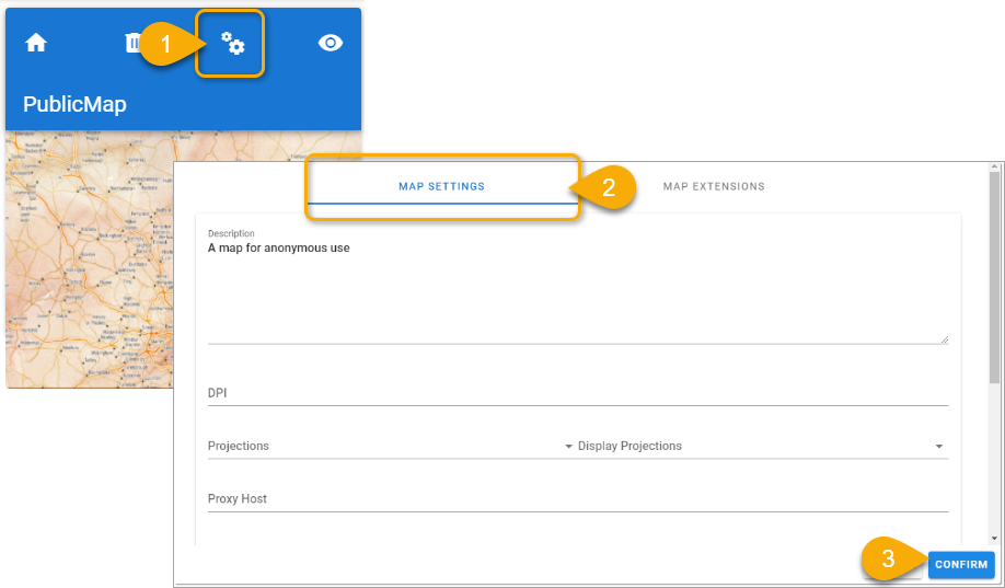
- Click Settings.
- Select Map Settings tab.
- Enter the relevant settings and click Confirm.
| FIELD | DESCRIPTION |
| Map Name | Enter a name for your map. |
| Description | Enter descriptive text to share more information about the contents of the map. |
| Map Title | Enter a descriptive title to be displayed to users. |
| Display Projection | This is the projection the map is ‘perceived’ to be in (the actual map projection could be 3857 to allow Google base mapping but the display projection could be 27700) This is useful to access returned coordinates in British National Grid. |
| Watermarks | Use the drop-down menu to select a watermark. |
| Copyright Statement | Add copyright statement if needed. |
| Centre X | Coordinate on which the map will be centred on its X axis. |
| Centre Y | Coordinate on which the map will be centred on its Y axis. |
| Initial Resolution | Initial resolution used when map is first opened. Resolutions are derived from a combination of scale and screen DPI. The lower the number, the closer in the map will be zoomed. Resolutions extend below 1 as decimal points for really zoomed in mapping. |
| Select | Use this option to select a location by clicking on a map. |
| Allow Anonymous Access | Allows map access to users when no authentication method has been set. If using Forms or Windows authentication, DO NOT choose this option. |
| Allow Map as Embedded | Enable to allow a specific map to be used as an Embedded map. |
| Allow human-interactive dialog check | This dialog will insist on user interaction on the map thus preventing automated attempts to overwhelm the server. |
| Enable Rate Limiter | Enable to prevent malicious DOS attacks on a particular map. The rate limiting option is also available on a wider site level. |
| Extent Min X and Min Y | Minimum and maximum bounding extent on X axis for layer rendering. |
| Extent Min Y and Max Y | Minimum and maximum bounding extent on Y axis for layer rendering. |
| Select Map Image | Click to choose a thumbnail image for the map; this thumbnail is displayed on the Manager home page. |