WebMap DXF Exporter
Use this option to quickly and efficiently export OS MasterMap data to CAD-ready DXF files.
Select Configuration on the map tile and click WebMap DXF Exporter. 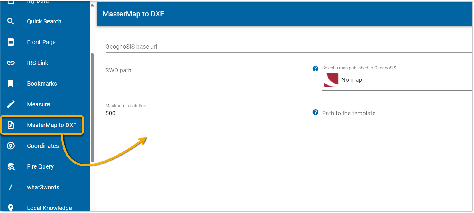
| Field | Description |
| GeognoSIS base URL | The base URL for the GeognoSIS SWD layer. This will be available in the format http://<server>:<port>/GeognoSis/9.1. |
| SWD Path | File path to a usable SWD. The SWD should be pre-processed and contain only two overlays. |
| GeognoSIS map | Select a map published to GeognoSIS. Leave blank if you have specified an SWD in the previous filed. |
| Maximum resolution | DXF export is possible only if the user is zoomed in at or below a defined resolution. Specify the resolution in pixels. |
| Path to template | File path to the DXF template supplied by Cadcorp. |
Files supplied by Cadcorp
The structure of the DXF output is defined by these two files (inlcuded with installation)
- Feature Table in the
Cadcorp_ACAD-MM_FeatureTable.nol - Default DXF Template file
Cadcorp_ACAD-MM_Template.dxf
Save these two files in a convenient location. Upload the 1. Named Object Library (NOL) to GeognoSIS. Add the path to the 2. DXF template in the relevant field (see above).
Click Save.
The user can now download any map view to a DXF file.
- The DXF will be exported to version DXF2018
- The export will be hairy i.e. if a feature is included in the Map Window view and extends beyond the Map Window, the entire feature will be exported.