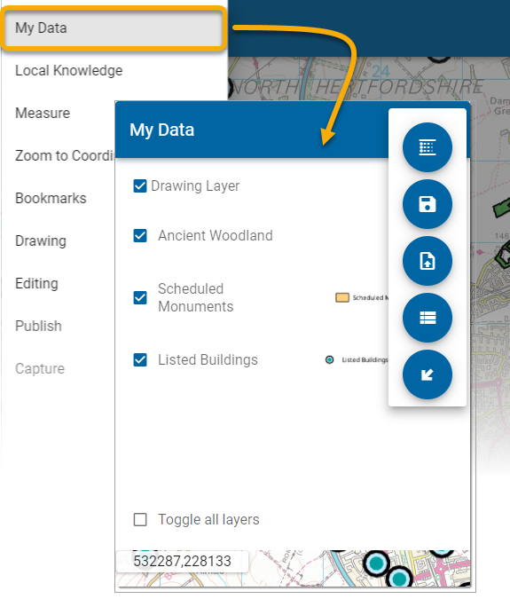
My Data
My Data displays all supported data layers from GeognoSIS SWD, WMS or WFS.
- Turn data layers on and off
- Add themes to existing layers
- Upload your own GeoJSON files
- View the data as Tables and export to CSV
- Export features
1. Turn data layers on and off
Click on the check box next to each layer to turn the layer on/off.
2. Add Theme 
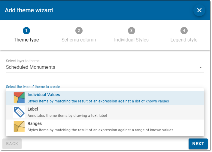
Use the Add Theme wizard to customise how data is displayed on each layer.
- Theme Type: Select the layer to be themed. Next select and theme type (Individual Values, Label or Ranges). See here
 for more information on Themes.
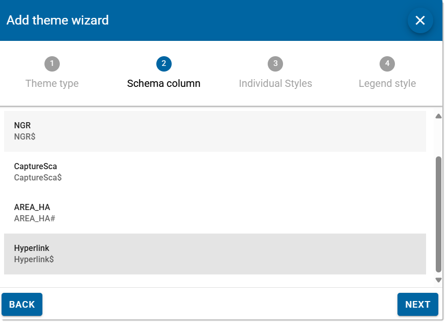
- Schema Column: Select the Schema Column
 on which the theme should be applied.
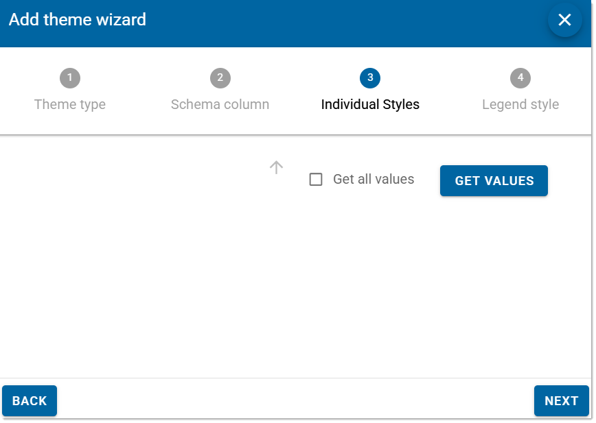
- Individual Styles: Each feature on the layer can be assigned individual styles and custom names. Click Get Values to see a list of attributes and select the attribute you wish to edit. Use Sort to order values as ascending or descending. You can change the fill and line colours and also assign a gradient or "spread" of colours.
- Legend Style: Customise the legend style including fonts, sizes, colours and background styles.
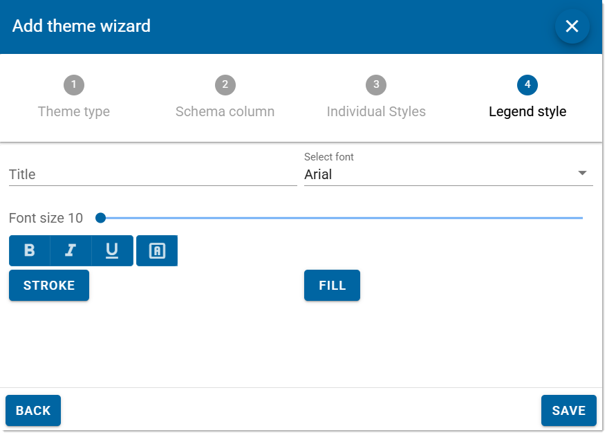
3. Add GeoJSON
Allows you to add a GeoJSON file to the map. These files usually contain geographical datasets and can be overlaid on top of other data.
Ensure the GeoJSON file is valid i.e. it contains geographic data like polygons, points, lines etc. You can change the stroke and brush of the data as well when you add the data.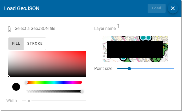
TIP: GeoJSON files are always available in CRS 4326 (Lat/Lon)
4. View Table
You can now view data in a handy table format. Simply select your layer and click Get Values. 
-
Use the Location icon
 to be automatically taken to the selected location.
 -
Use the Export option to download data as a .csv file.
-
By default, only items that are available within the map window are displayed. Enable Show On Screen Only to toggle between displaying all table values.
-
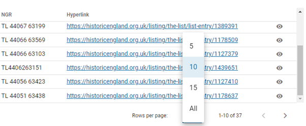
Use the table controls to manage the number of rows which are visible at any given time.
-
Use the Export button to download data as a .csv file. This will download all rows currently available i.e. all rows in the layer if the Show On Screen Only option is turned off.
5. Export Features
Export data as a downloadable .csv file. You can either export the whole layer or only features currently seen on the screen.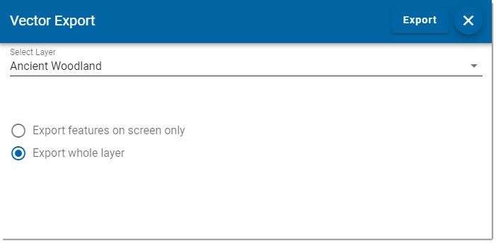
Certain layers can be exported to GeoJSON to allow geometry and attributes for the whole layer.
You can also export the current view and re-create it in an open format vector file. This includes user created features on the Drawing Layer.
Select the layer to be exported. You can either export the whole layer or just the features on screen.
Click the Export button to create the download.
