Add Additional Layers
Use this option to include more layers on the map.
Note: These layers are available on the user map with the More Mapping option 
Select Layers > Add Additional Layers from the main menu and choose the type of additional layers to be added to your map.
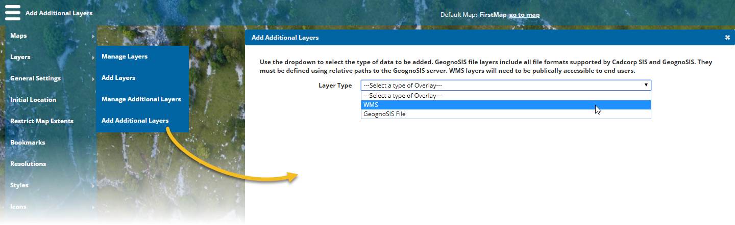
WMS
(OGC Web Map Feature Service) – Add data being served out as a WMS. WMS will need to be publicly accessible to end users. ![]() Related Topics
Related Topics
GeognoSIS File
Add any file format supported by SIS and GeognoSIS.
The paths to these files must be defined relative to the GeognoSIS server. For example if the data was stored on the C drive of the GeognoSIS server, the path would simply be C:/file name (regardless of the machine the Administrator is using to add the data).
Additional layers do not appear automatically in the user’s Map Features. Add them manually using More Mapping option. A browser cookie remembers to include this layer next time the user opens the site.