
Creates a Terrain Ruggedness Index map (the average difference in elevation between a Grid cell and each of the surrounding cells) from a Grid.
Creates a Topographic Position Index map (the average difference between the elevation of a Grid cell and the mean of the elevations of each of the surrounding cells) from a Grid.
Creates an Aspect map (the azimuth, or angle, of the slope in a Grid cell) from a Grid.
Properties
Algorithm*
The aspect algorithm to use. Hom/Zevenbergen & Thorne.
Trigonometric*
Should the aspect values be returned as a trigonometric' angle (in degrees anti-clockwise from east/the X axis) instead of an azimuth (in degrees clockwise from north)? True/False.
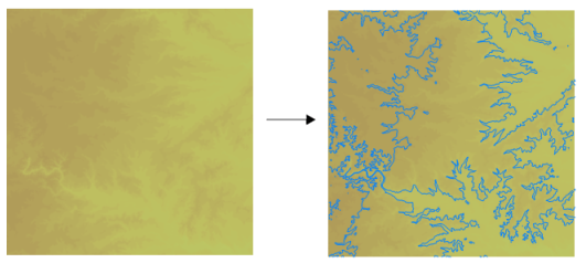
Creates contour LineString Items from a Grid, at fixed intervals.
Properties
3D*
Should the LineString Items have their height set to match the contour level? True/False
Interval*
The interval between contour levels, as a simple value, or as an expression.
Offset*
The offset, relative to 0.0, to apply to the fixed interval contour levels, as a simple value, or as an expression.
Typical contour display:

Creates contour LineString Items from a Grid, at fixed levels.
Properties
3D*
Should the LineString Items have their height set to match the contour level? True/False
Levels*
The contour levels, as a space- or comma-separated list of values, or as a 'repeat string', e.g. '100 200 300' or '100 repeat 3'.
Typical contour display:

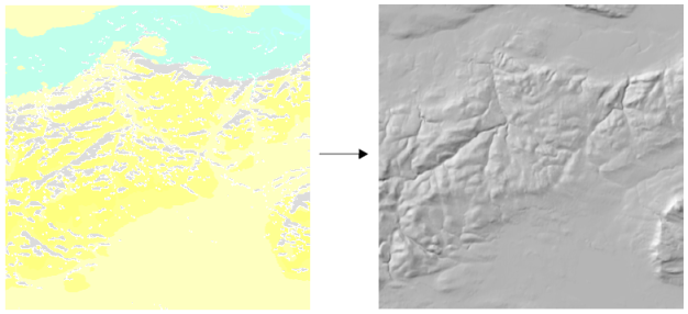
Creates a shaded relief map from a Grid. This process is suited to OS LandForm PANORAMA DTMs.
Properties
Algorithm*
The slope and aspect algorithm to use. Hom/Zevenbergen & Thorne.
Altitude*
The altitude of the light, in degrees between 90 (vertical) and 0 (horizontal), as a simple value, or as an expression.
Azimuth*
The azimuth of the light, in degrees clockwise from north, as a simple value, or as an expression.
Combined*
Should the shaded relief map be created using a combination of slope and oblique shading?
Exaggeration*
The exaggeration factor to apply to vertical values, as a simple value, or as an expression.
Z Ratio*
The ratio between the vertical units and the horizontal units, as a simple value, or as an expression.
Typical Hillshade display:

Explodes a Grid Item into one Point Item per Grid cell.
Property
Set Z
Should the 'Z' of the Point Items be set to the Grid cell value (in addition to an Item attribute)? True/False.
Creates a coverage of Polygon Items from a Grid.
Property
3D*
Should the LineString Items have their height set to match the height in the Grid? True/False.
Explodes a Grid Item into one Polygon Item per Grid cell.
Property
Set Z
Should the 'Z' of the Polygon Item vertices be set to the Grid cell value (in addition to an Item attribute)? True/False.
Creates a Roughness map (the largest difference in elevation between a Grid cell and those of the surrounding cells) from a Grid.
Creates a Slope map (the angle, or percentage, of the slope in a Grid cell) from a Grid.
Properties
Algorithm*
The slope algorithm to use. Hom/Zevenbergen & Thorne.
Percentage*
Should the slope values be returned as a percentage. Instead of an angle?
Z Ratio*
The ratio between the vertical units and the horizontal units, as a simple value, or as an expression.
Sets the value of all Grid cells that match a comparison against the 'from' value to the 'to' value.
Properties
'From' value
The original value to compare, as a single value, or as an expression, e.g. '123' or '_AverageGridVal# + 2 * _StdDevGridVal#'.
'To' value
The new value to use, as a simple value, or as an expression. e.g. '321' or '_NoDataGridVal#'.
Comparison
The comparison to use when testing the original value.
The full range of comparison options available are:
Less than
Less than or equal to
Equal to
Greater than or equal to
Greater than
Not equal to
Click here to return to the Run new Process main topic.
Click here to return to the Theme Types dialog - Operation tab - Process topic.
Send comments on this topic.
Click to return to www.cadcorp.com
© Copyright 2000-2017 Computer Aided Development Corporation Limited (Cadcorp).