 (Group) Linear (100).gif) Linear (measure positions along a path) Linear (measure positions along a path)
Linear (measure positions along a path) Linear (measure positions along a path)
 button (100).gif) Linear can measure positions using distances along a path. This command specifies the path along which distances will be measured.
Linear can measure positions using distances along a path. This command specifies the path along which distances will be measured.
This method of measuring positions is sometimes used in applications such as Road maintenance. Each position can be simply stated using a single number (plus a road name). Also, the approximate position can be simply found by an engineer in the field by using a vehicle's tachometer (sometimes aided by milestones).
After picking this command, you must enter the path using a series of positions, and use Enter to finish. Then future positions will be displayed in the Status Bar.
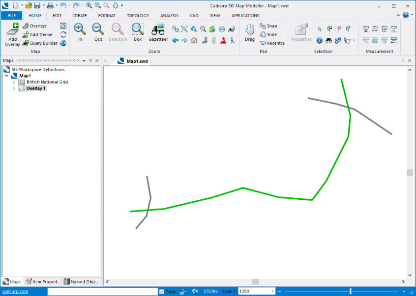
To place a number of positions along the green LineString Item below:
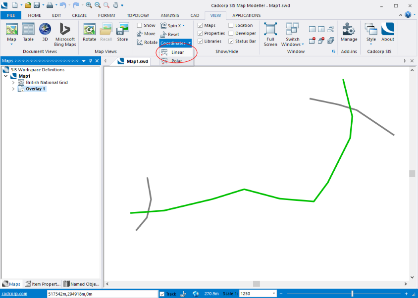
Go to the View tab and select Coordinates > Linear:
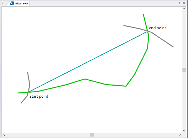
Draw a line from the required start point to the end point. Double click to complete the line.
The line will trace the LineString Item between the start and end points, it is not necessary to manually trace the LineString Item along its length:
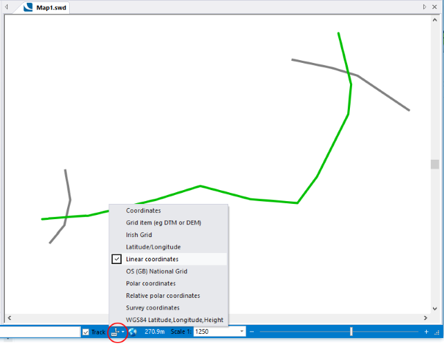
Select Linear coordinates from Coordinates/Axes drop down in the Status bar:
Go to the Create tab.
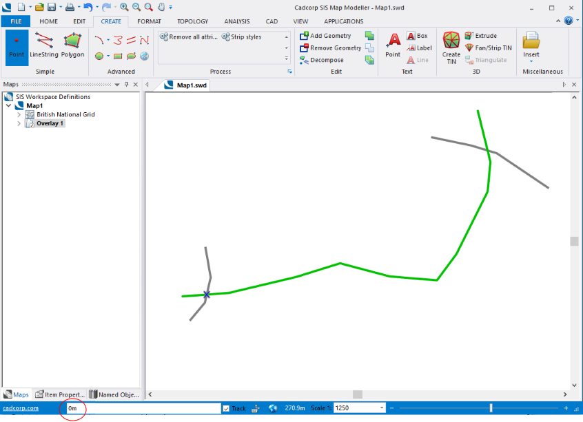
Click on Point (in the Simple group) and place a point at the required start position. The point will show as 0m in the position bar:
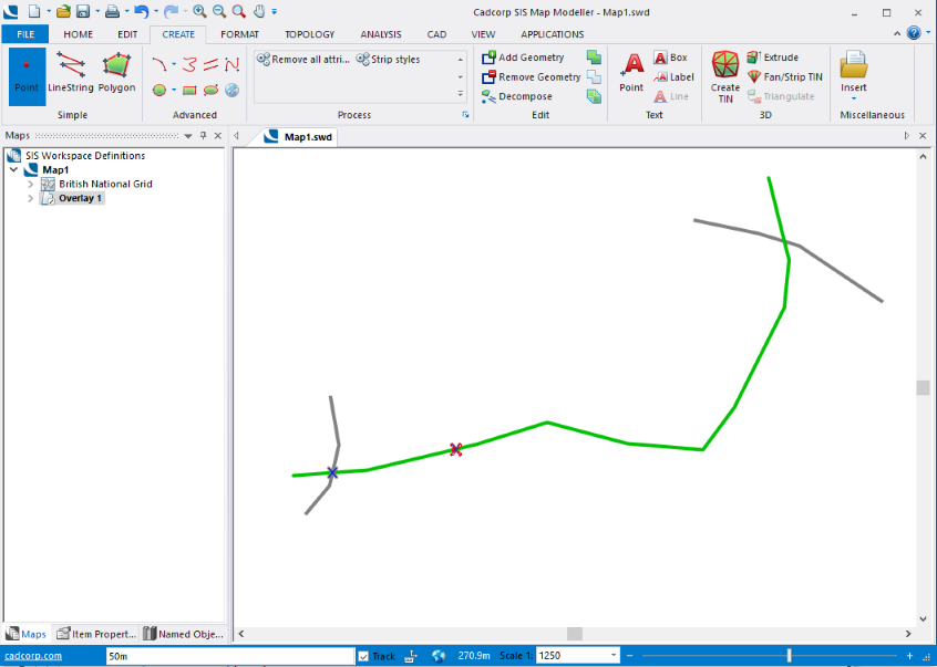
Enter 50m in the position bar and press Enter. The second point will be created at a distance of 50m from the start point:
Enter 100m in the position bar and press Enter. The third point will be created at a distance of 100m from the start point:

Enter 200m in the position bar and press Enter. The fourth point will be created at a distance of 200m from the start point.

Note: You can only enter a single value for each point, it is not possible to use multiple points at one time, i.e. 100m, 200m, 300m or 100m r 3 will not be recognised.
On completion the coordinate reference system can be returned to the original setting in the Coordinates/Axes drop down.
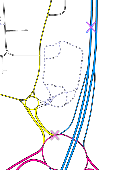
The crosses are the start and end points.
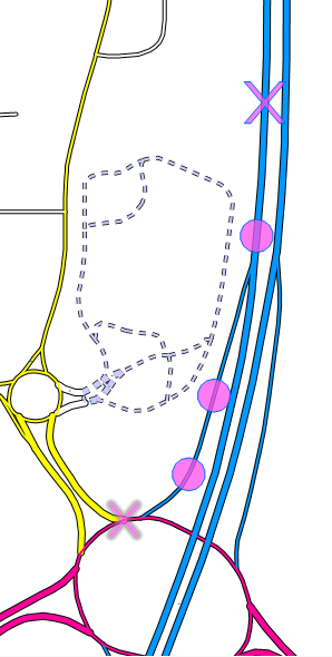
The circle symbols are the set distances from the start point along a road:
Top of page
Click to return to www.cadcorp.com
© Copyright 2000-2017 Computer Aided Development Corporation Limited (Cadcorp).