button (WW).gif) Properties... (Dataset) Properties... (Dataset)
Properties... (Dataset) Properties... (Dataset)For internal overlays:
.png)
For RDBMS cursor datasets:
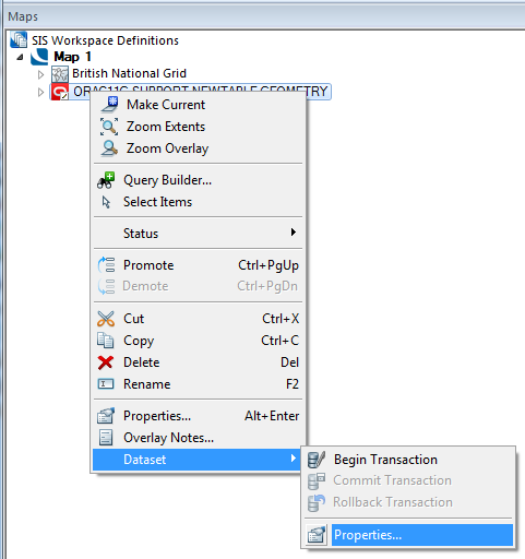
Properties... displays the details of the dataset referenced by the overlay.
If the overlay is an RDBMS cursor dataset with a status of Editable the Cursor Dataset Details dialog will be displayed:
.png)
Data Columns
Name/Type/Indexed
Fields in the dataset.
Column
Create
Creates a new field.
The New Field dialog will be displayed:
Details
Name
Name for the new field.
Type
Select the type from the drop-down box. See Attributes Overview.
Delete
Deletes an existing field.
Index
Create
Creates an Index on an existing field.
Delete
Deletes an Index on an existing field.
Feature Table and Feature Code Column
Table
The Feature Table to use for feature-coded Items in this Dataset.
Feature-coded Items get information about their Feature Code from this Feature Table.
Column
The Field that will be used to set the Feature Code on Items in the Dataset.
Transactions
Begin
Start a transaction. Begin editing the data.
After the edits have been made you have two options: Rollback or Commit.
Rollback
This will release the transaction and allow other users to obtain editable access to the data. The changes you made will not be applied to the dataset.
Note: Regenerating an overlay whilst in the middle of a transaction causes the transaction to roll back. In addition all undo information for the overlay will be cleared.
Commit
This will commit the changes permanently to the database and release the transaction. All users will now be able to view the data.
Only allow editing inside a Transaction
Check this tickbox to ensure edits can only be made if a transaction is current.
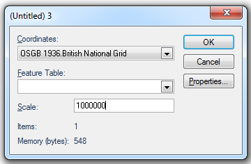
More Properties...
Allows you to view and modify further dataset properties:
Coordinates
The coordinate system that the dataset items are defined in. To view or edit the coordinate system details drop-down the combo box list, and press the right arrow at the bottom.
Feature Table
The feature table to use for feature-coded items in this dataset. Feature coded items get information about their feature code either from this feature table, or, if set, their own Feature Table property.
Scale
The default viewing scale for this dataset. This will affect how Text items convert their point heights into world sizes.
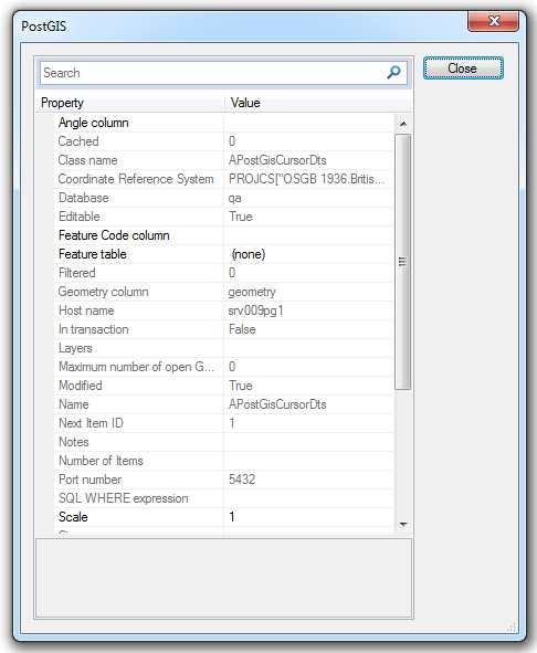
Click the Properties... button to display the Cursor Dataset properties dialog (PostGIS shown):
Click Close, click OK on the previous dialog, in this case APostGisCursorDts.
Click Finish on the Cursor Dataset Details dialog.
Top of page
Click to return to www.cadcorp.com
© Copyright 2000-2017 Computer Aided Development Corporation Limited (Cadcorp).
.png)