Location: Overlay Types > Ordnance Survey Great Britain > OS MasterMap Topography Layer > Microsoft SQL Server Spatial Dataset
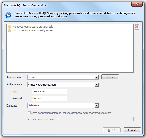
The Microsoft SQL Server Connection dialog will be displayed:

Server
Select a server name from the drop-down list, or type the location of the server where the database you want to access is located. Selecting the database on the server is a separate action. Click Refresh to refresh the list.
Use Windows NT Integrated security
Select if the provider is to request a secure (or trusted) connection to a Microsoft SQL Server running in Windows NT. When selected, SQL Server uses integrated login security to establish connection using this data source, regardless of the current login security mode at the server. Any login ID or password supplied is ignored. The SQL Server system administrator must have associated your Microsoft Windows network ID with a SQL Server login ID.
Use a specific user name and password
Select to use a supplied user name and password to authenticate your logon information to the data source.
User name
The user ID to use for authentication when you log on to the data source.
Password
The password to use for authentication when you log on to the data source.
Database
Type the name of the database that you want to access or select it from the drop-down box.
Save connection details in Options database (with encrypted password)
Check this tickbox if SIS should store these connection details in the Options database. The password will be stored in encrypted form for security.
Saved connection name
This text box will become active if the Save connection details in Options database (with encrypted password) tickbox is checked. Enter a meaningful name for this connection. This text box cannot be left blank and the same name cannot be used twice.
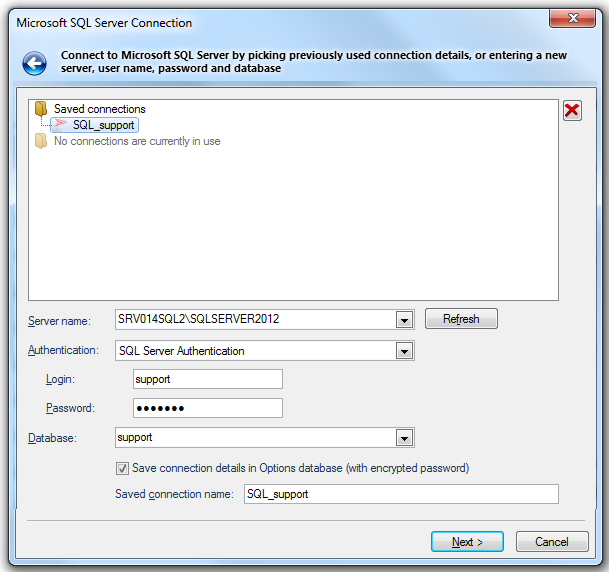
If the Microsoft SQL Server Connection has been made previously, and the connection details saved, the Microsoft SQL Server Connection dialog will be displayed in the form shown below:

In this case click on one of the Saved connections or Currently used connections (if any are in use) to complete the connection details.
Click Next.
The Microsoft SQL Server Spatial Data Sources dialog is displayed:
.png)
Select the required Microsoft SQL Server Spatial data source to load.
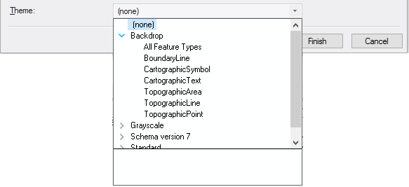
Theme

Allows you to select the theme type suited to your required styling.
Click Finish.
Send comments on this topic.
Click to return to www.cadcorp.com
© Copyright 2000-2017 Computer Aided Development Corporation Limited (Cadcorp).