-OS MasterMap Imagery Layer icon.png) MasterMap Imagery Layer MasterMap Imagery Layer
MasterMap Imagery Layer MasterMap Imagery LayerLocation: Overlay Types > Ordnance Survey (GB) > MasterMap Imagery Layer
Use the Ordnance Survey MasterMap Imagery Layer dialog to find the root folder containing the OS Mastermap Imagery Layer files and click Finish:
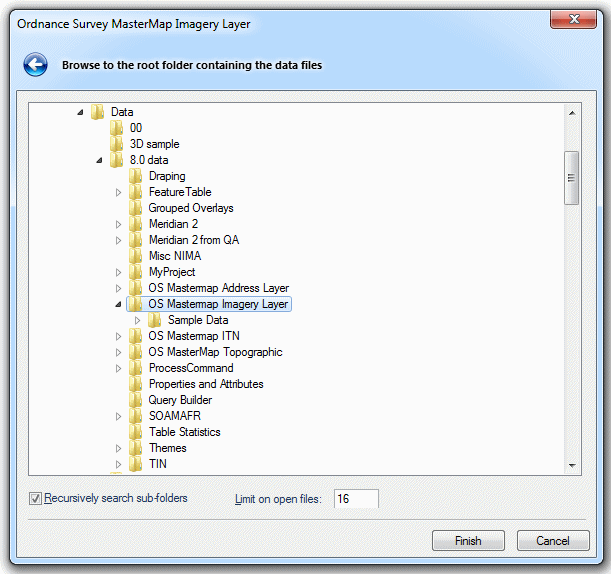
The raster images in the folder are displayed. You can limit the number of files opened. It is also possible to recursively search and thus display images found in sub-folders below the root folder selected.
Click to return to www.cadcorp.com
© Copyright 2000-2017 Computer Aided Development Corporation Limited (Cadcorp).