Cadcorp SIS Products
SIS stands for Spatial Information System, a generic term which covers the full range of Cadcorp products.
Computer Aided Development Corporation Ltd. (Cadcorp) was founded in 1991. Since then we have been developing a range of Spatial Information Systems. All of our software products are generated from a common pool of C++ objects and share many commands and functionality.
All Cadcorp products conform to OGC interface specifications and are at the cutting edge of GIS functionality and industry standards.
This help text describes all of the SIS suite since there is a large overlap in the individual products. SIS is the generic term for all Cadcorp software products and some of the features described may not be available in all products.
Data Access
Map Express: an intuitive versatile tool for quickly and easily viewing, thematic display and printing of over 160 GIS, CAD, graphic and database formats. This product is free to download and distribute.
Data Management and Creation
Map Manager: Map Manager is the mainstream GIS application and provides users with the capability to capture, edit, manipulate, view, analyse and export spatial information. Map Manager uses powerful Wizards to guide the user through spatial searching, thematic presentation and printing.
Map Editor: Map Editor offers all the capabilities of Map Manager. Map Editor enables more advanced GIS functionality such as advanced CAD-style geometric construction and editing, topology and links to relational database management systems.
Map Modeller: Map Modeller extends the functionality of Map Editor. Map Modeller provides users with a comprehensive set of creation, editing and modelling capabilities including 3D modelling, grid analysis, terrain modelling and image draping.
Develop
SDK Software Developer Kit: provides developers with access to the Cadcorp SIS API. It can be used to develop Cadcorp SIS desktop applications and to integrate with third party applications.
GeognoSIS Development: provides developers with access to the complete Cadcorp GeognoSIS API (SOAP and HTTP interfaces.
EDK Enterprise Developer Kit: provides developers with access to the Cadcorp SIS desktop and Cadcorp GeognoSIS API.
Deploy
ActiveXViewer: the lowest level ActiveX runtime version of SIS.
ActiveXManager: the ActiveX runtime version of Map Manager
ActiveXModeller: the ActiveX runtime version of Map Modeller
Distribute
Map Express: a free desktop application which allows users to build structured data-sets from existing file and database sources.
GeognoSIS Deployment: makes the wide-ranging functionality of SIS available over the Web for interactive mapping services, or a corporate intranet for enterprise-wide deployment of GIS applications and data. It can also be used for serving data using a variety of OGC and industry standard services.
Unicode support
All Cadcorp SIS products support the Unicode Standard. The Unicode Standard is the universal character encoding standard for written characters and text.
32 and 64-bit versions of products
All the above Cadcorp SIS products are available in 32 and 64-bit versions.
To identify the version of the product you have click the About button in the View tab:

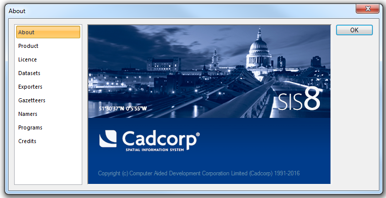
The About dialog will be displayed.
Note: All dialogs in this help have been created using the Microsoft Windows 7 operating system and may differ for other operating systems.
The first tab is the About tab:

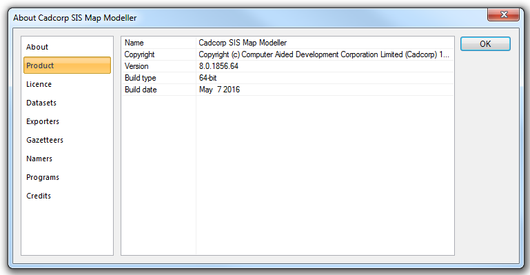
The Product tab:

This tab shows the following:
Name
The name of your product. In the above example the Product is Cadcorp SIS Map Modeller.
Copyright
Cadcorp copyright details.
Version
Indicate the version of your product
Build type
32-bit - indicates the product is a 32-bit version.
64-bit - indicates the product is a 64-bit version.
Build date
The date of the software build.
The Cadcorp address is:
Computer Aided Development Corporation Ltd.,
Sterling Court,
Norton Road,
Stevenage,
SG1 2JY
United Kingdom
Tel: +44 (0) 1438 747996
Fax: +44 (0) 1438 747997
Our website is: www.cadcorp.com
If you have any queries or comments please email us.
The Cadcorp Portal is a download hub for all Cadcorp products. It also features a forum and knowledge base. Registration is required.
Cadcorp SIS, Map Express, Map Manager, Map Editor, Map Modeller, SIS ActiveX, GeognoSIS and GeognoSIS Express are all Copyright ©Computer Aided Development Corporation Ltd. MapTips™ and Cadcorp™ are registered trademarks of Computer Aided Development Corporation Ltd.
The names of other companies and products herein are trademarks or registered trademarks of their respective trademark owners.
Send comments on this topic.
Click to return to www.cadcorp.com
© Copyright 2000-2017 Computer Aided Development Corporation Limited (Cadcorp).


