PNG is a lossless data compression format but only supports a single image layer. It is a memory based dataset and typically has the extension *.PNG.
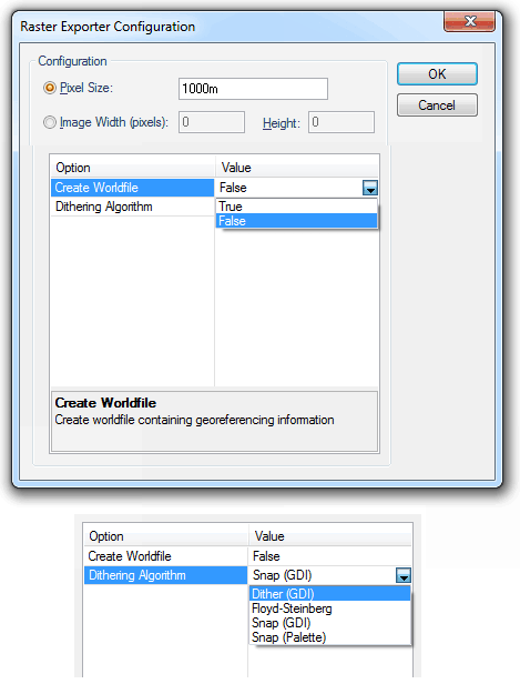
When exporting the current view the Raster Exporter Configuration dialog is displayed:

Configuration
Pixel Size
This option specifies the image resolution.
Image Width/Height
This option specifies the output file size in pixels for width and height and the pixel size is in map units.
Create Worldfile
True or False, to create worldfile containing georeferencing information.
Dithering Algorithm
Select from Snap (GDI), Dither (GDI), Floyd-Steinberg, Snap (GDI), Snap (Palette).
See full list of Export Formats
Click to return to www.cadcorp.com
© Copyright 2000-2017 Computer Aided Development Corporation Limited (Cadcorp).