Base Layers
In Web Map Layers 8.0, there are two types of data layer; Base Layers and Data Layers.
Base Layers are used as background mapping and cannot be interrogated or queried. A Base Layer must be included in order for the map to work.
Data Layers see the Data Layers topic.
In the Web Map Layers 8.0 interface, Base Layers are listed in the top right hand corner of the map window. They are presented as a dropdown list which allows the user to select the appropriate Base Layer.
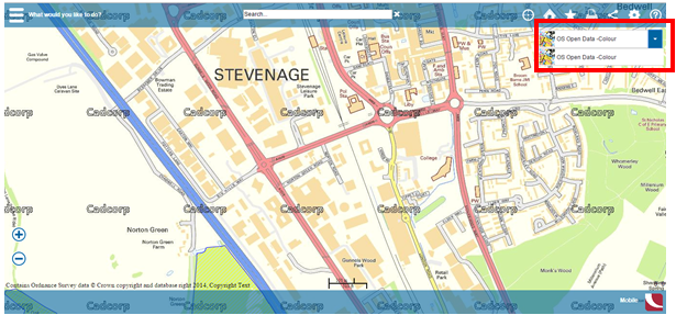
As you can see, a number of different Base Layers can be defined by the administrator, but only one Base Layer is ever visible at any time. Using multiple Base Layers allows the administrator to present, for example, a colour topographic map, a black and white topographic map and aerial photography Base Layers, with the user having the option to switch between them.
Base Layers can be served using a range of different formats, but it is recommended that Base Layers are served using a tile cache, Google Maps or Bing Maps for optimum performance. Base Layers need to be displayed at all view resolutions.
Support included for Base Layers includes:
- Regular Layer Cache, known as GoogleDisk (Recommended)
- TileCache Layer Cache, known as Disk (Recommended)
- Google Maps (Recommended)
- Bing Maps (Recommended)
- OpenStreetMap
- OGC WMS
- OGC WMTS
- OGC WFS
- ESRI REST API
- Cadcorp Tile Services
You can create a Base Layer in the Admin Interface by selecting the Add Layer option and choosing one of the above layer types.
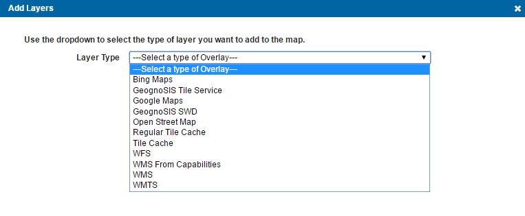
When selecting Regular Tile Cache, Tile Cache, Bing Maps, Google Maps and Open Street Map, these layers can only be created as Base Layers and will appear as part of the Base Layer selector.
Other layers can be created as either Data or Base Layer. To create them as Base Layers, you must check the Is Base Layer tickbox when creating the layer.

Send comments on this topic.