Point-to-point
Point-to-point is used to find the distance between two points on LineString and Link items and the perimeter of Polygon items.
You will see a route drawn between the points. To use this command, ensure the items intersect and are on an editable or hittable overlay.
Select Analysis > Routing > Point-to-point.
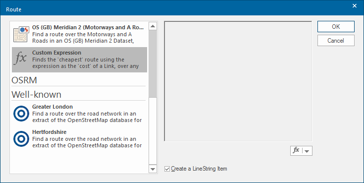
This opens the Route dialog:
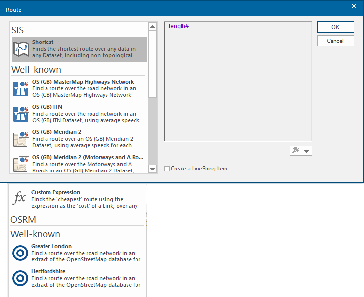
Select one of the point-to-point options.
- Shortest - Finds the shortest route. This method can be used with any geometry.
- Well-known- choice of well-known mapping networks.
- Custom Expression - Finds the route that minimises the addition of an expression or simple property values. This method only works with Link/Node topology. For example, use "_length#" to achieve the same effect as the Shortest option, but only using the Link item geometry.
Create a Line String Item - Check this tickbox if you want to create a LineString item along the found route. This enables you to store the geometry of the route as a permanent item for future use.
Using Point-to-point:
Routes can be measured on external data such as Ordnance Survey MasterMap
TIP: Be aware however with OS MasterMap digitising styles, you will often find what appears to be a single LineString item is in fact made up of several shorter LineString items).
You can also route find on LineString items created with LineString and Freehand and on the outlines of closed Polygon items.
For example: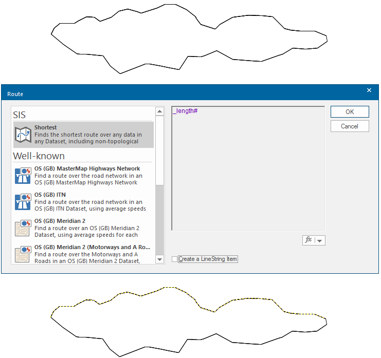
Route-finding is especially powerful with topology where routes can be found across a link and node network. The route can also be based on a chosen expression.
- Select Point-to-point to display the Route dialog (shown above).
- Select how the route should be measured:
- Check the Create a Line Item tickbox if you want to create a new LineString item along the found route.
To define a route on a vector network from point A to point B SIS Desktop will find a route across the network, generate the LineString item and place it in an editable overlay: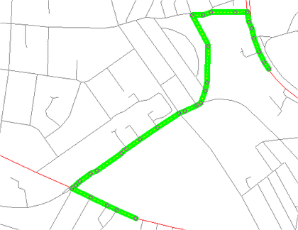
In this case the LineString item's length is expressed as an attribute: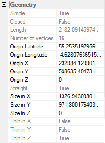
Route options
- Shortest Route
- OS (GB) MasterMap Highways Network
- OS (GB) ITN
- OS (GB) Open Roads
- OS (GB) Meridian 2
- OS (GB) Meridian 2 (Motorways and A Roads)
Custom Expression
Finds the 'cheapest' route using the expression as the 'cost' of a Link, over any Link/Node network.
OSRM - Well-known
OSRM uses a custom database and creates routes faster than the other options. The custom databases can be created using the OS Network Manager. The custom databases are stored in the OSRM folder of the SIS Desktop 9 installation.
Greater London
Finds a route over the road network in an extract of the OpenStreetMap database for Greater London, using the 'car' profile.
Hertfordshire
Finds a route over the road network in an extract of the OpenStreetMap database for Hertfordshire using the 'car' profile.