Format Settings
Format Settings includes:
-
Service URL
-
Map Name
-
Marker Colour
-
Marker Size
-
Map Control switches
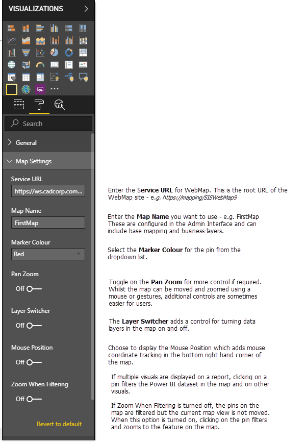
TIP: See here for more information on Layer Switcher.
GeognoSIS Refresh Interval
GeognoSIS Refresh Interval is a new option available in Map Settings. This provides the option to refresh underlying mapping that is served by GeognoSIS. It can be used to provide accurate and recent versions of data.
The mapping data is loaded when the Power BI report is accessed. Some dynamic layers in the SWD may be updated during the session; for example, a live display of vehicles accessed using a spatial database table. Unless the GeognoSIS Refresh Interval is set, these dynamic layers of data will not be displayed at their most recent location during the session.
Power BI data displayed with the mapping is not affected by these settings; this option needs to be controlled using Power BI settings.
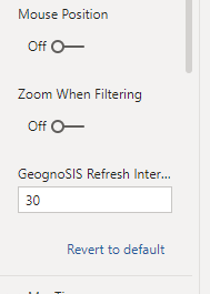
If the GeognoSIS Refresh Interval is left blank or set to zero, the underlying mapping will not refresh.
Set a value (in seconds) for the refresh interval of the SWD data. This refreshes the mapping data in the background without forcing a redraw of the Power BI data overlaid on the map.
NEXT: Map Tip Settings ![]()