Coordinate Reference System
A Coordinate Reference System is a method of projecting positions from the curved surface of the Earth to a flat screen or paper.
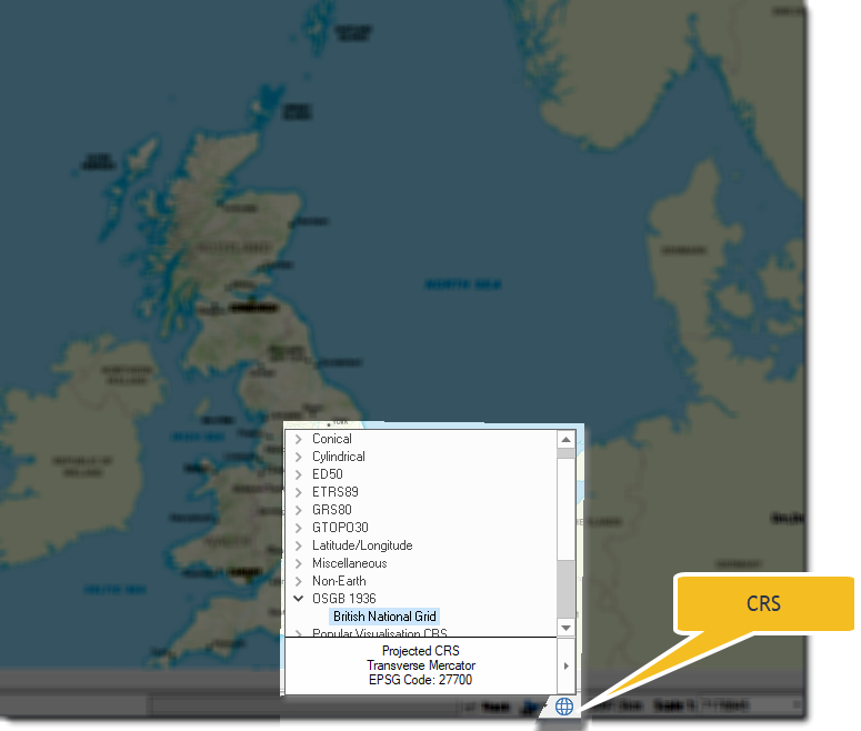
SIS Desktop allows you a choice of CRS  to work better with various maps.
- If you are working on UK data, the default CRS is most likely to be OSGB 1936.British National Grid.
- If you are using Ordnance Survey data, the map defaults to OSGB 1936.British National Grid.
Use the Units tab to change the default display method for the units on screen.