Selecting the Coordinate Reference System
The Coordinate Reference System (CRS) enables the Earth’s surface to be mathematically transformed and rendered on screen. The CRS is the reference used to interpret and report spatial positions in datasets.
Notes on Coordinate Reference Systems
- A SIS Workspace Definition (SWD) has a default coordinate system (or more precisely both a Coordinate Reference System and a Viewing Projection).
- Each SWD has a Coordinate Reference System that it remembers.
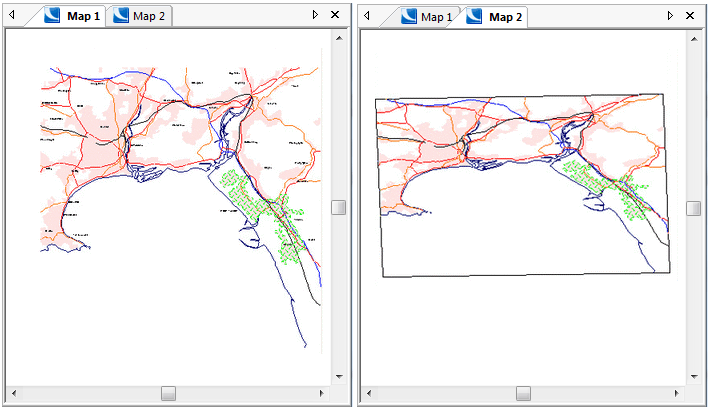
- Each map window can have a different Coordinate Reference System. This means you can have the same SWD displayed in different windows with a different CRS in each window.
- When you start a Cadcorp SIS Desktop session, the default Coordinate Reference System is Latitude/Longitude.OGC.WGS_84 (this is editable). New SWDs adopt this CRS automatically.
- When opening an SWD, it uses the Coordinate Reference System active at last Save. This can be changed anytime.
- Each map window can use a different Coordinate Reference System. You can select either a Viewing Projection or a CRS for the current window using CRS.
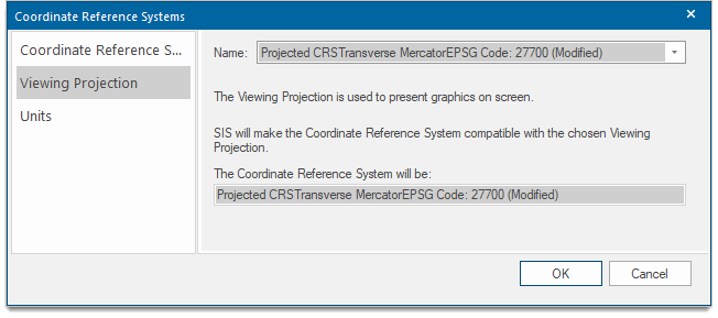
The Viewing Projection is used to present graphics on screen. If you choose a Viewing Projection, Cadcorp SIS Desktop makes the Coordinate Reference System compatible with it.
If you choose a Coordinate Reference System, the Viewing Projection is made compatible.
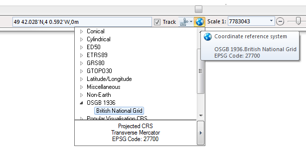
Alternatively you can change the Coordinate Reference System by clicking on the globe icon located on the right hand side of the status bar:
The following example shows some Ordnance Survey Meridian data. First it is displayed using its standard Viewing Projection (OSGB 1936.British National Grid), then using a Latitude/Longitude Coordinate Reference System: