Measure Angle
Measure Angle measures the internal and external angles formed between two LineString items or LineString item segments.
This can be useful for engineers on site capturing data; for e.g. knowing a point is on a position on the ground with the next point at a 20 degree angle and 30m away.
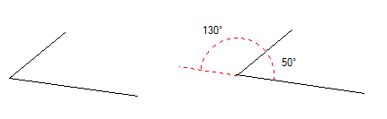
TIP: If the LineString items are not connected, you will see the angle which would be formed if they were extended to meet.
Select Home > Measurement > Angle: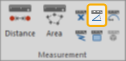
Select the first LineString item and then the second LineString item that forms the angle to be measured:
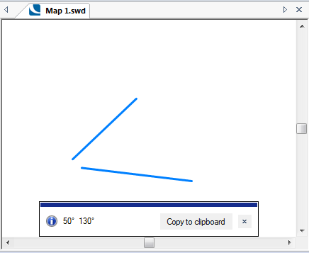
An  Information box shows two values (inside and outside angles) formed by the LineString items:
The units and number of decimal places are those set in the Coordinate Reference Systems dialog; these can be degrees, radians, DMS (degrees/minutes/seconds), gradians or DM (degrees/minutes).
To change the units or number of decimal places, see Home > Map > CRS > Units.
Click the Copy to clipboard button to copy the values to the Windows clipboard as text.
When pasted back, the values are placed as a text item at the centre of the current map window. They can also be pasted into a text dialog box or a spreadsheet.
Click the x button in the Information box to dismiss the message.