CRS
CRS sets up the current Coordinate Reference System, the current Viewing Projection and the current Units.The Coordinate Reference System is used for measuring positions and storing graphics in datasets.
Select Home > Map > CRS.
Alternatively right-click inside the Map Window and select this option.
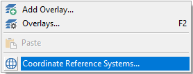
The right-click context menu option is only available when no overlays are present.
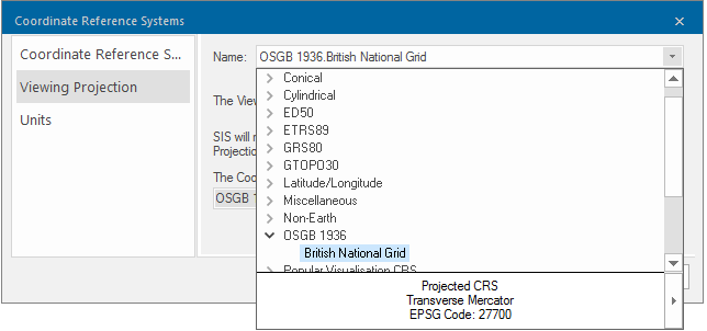
Coordinate Reference System
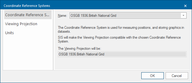
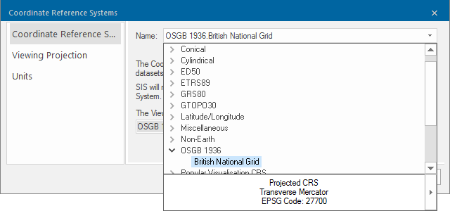
Name: Select the required Coordinate Reference System from the drop-down box. This will change the meaning of typed coordinates and may affect measurements.
The Viewing Projection will be: This displays the viewing projection in accordance with the Coordinate Reference System chosen above
There are two different types of coordinate reference systems - Cartesian and Spherical.
- The X, Y and Z axes of a Cartesian coordinate reference system are orthogonal to each other and the units are linear (metres, miles, etc.).
- The X and Y axes of a Spherical coordinate reference system are angles of latitude and longitude. The Z axis of a spherical coordinate reference system measures height above sea-level.
Viewing Projection
The Viewing Projection is used to present graphics on screen.
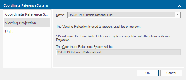
Note: SIS Desktop displays the Viewing Projection in accordance with the chosen Coordinate Reference System.
Name
Select the required Viewing Projection from the drop-down box. The viewing projection determines how the curved surface of the Earth is mapped onto the screen.
For simplicity SIS Desktop keeps the Coordinate Reference System and the Viewing Projection compatible with each other. If you change one, SIS Desktop automatically changes the other.
Units
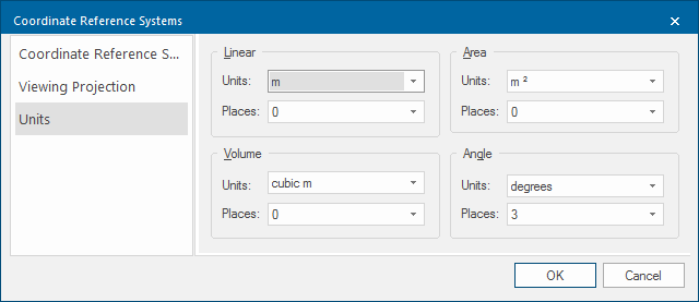
Determines how coordinates are displayed in the Status Bar and how they are displayed when you use the Measure commands, e.g. Measure Distance.