Creating a Topological Polygon Network
This example shows the processes involved in creating the topology of a smallholding.
Here TopoPolygons represent woodland, fields, buildings and roads.
The example will concentrate on TopoPolygons and TopoLineStrings. The Link and Node primitives will be created using the methods described above particularly Create Network (Topology > Convert).
- In the previous example a set of LineString items were selected and Create Network [Topology-Convert] was used to create Links and Nodes.
- Logical entities called TopoLineStrings can then be created to represent named roads, transport routes, etc. The same process can be used to form the basic structure for a network of TopoPolygons.
- Logical entities called TopoPolygons can also be created to represent fields, rivers, buildings, etc. The advantage of a topological polygon network is again that the geometry is stored only once, by the Links. These Links define the boundary between two adjacent TopoPolygons, so a change to one automatically becomes a change to the other.
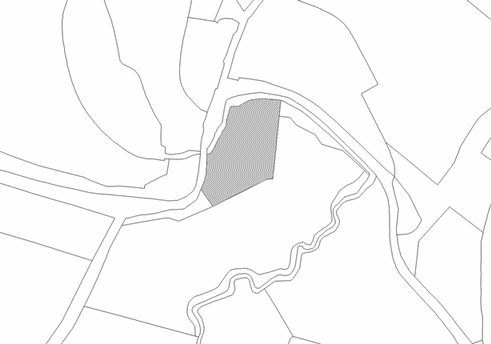
An example of an area of countryside drawn in simple LineString items is shown below: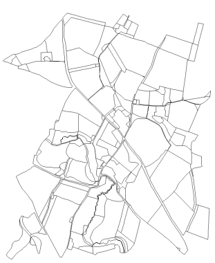
Select all the items on the map Select All (Home > Selection) ) then click the right mouse button and select Create Network (Topology > Convert). This will create Links from each LineString segment, inserting Nodes at the junctions. Now you are in a position to start creating TopoPolygons to represent the fields and other land parcels.
Zoom in to the area where the TopoPolygons are to be created. Select TopoPolygon (Topology > Build) and click within the area to be created as a TopoPolygon. You will see the area filled in grey:
If the TopoPolygon that you want to capture is made up of several areas enclosed by the Links, simply click within further areas. When the required area(s) are highlighted, press the Enter key to confirm, and a TopoPolygon is created. Note that no additional geometry is added. A TopoPolygon is represented by a “seed point” which holds a list of the Item IDs of the constituent Links.
Repeat this process to capture further TopoPolygons. Note that TopoPolygons can overlap each other. The only constraint is that they must be totally surrounded by Links.
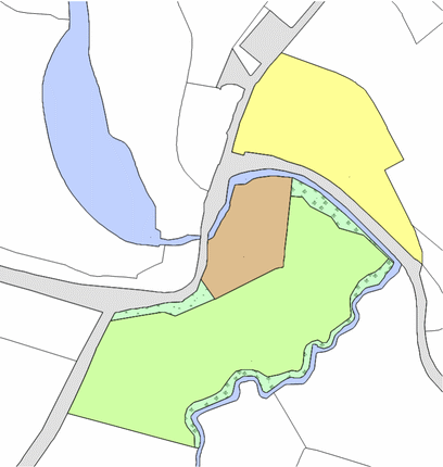
Pictured below is the land holding after the TopoPolygons have been captured. Each TopoPolygon has been coloured for clarity:
The following Construct/Topology commands may be used when creating TopoPolygons from a Link and Node network:
- TopoPolygon - Builds a TopoPolygon out of link/node data using seed positions.
- From Polygon - Creates TopoPolygons inside a polygon fence.
- From LineString - Creates TopoPolygons crossed by a LineString fence.
- From Items - Creates TopoPolygons seeded by selected items.