Configuring SWDs to use with Edit Add-In
To allow users to edit a database layer, tweak the original SWD file using CadcorpSIS Desktop.
- Add the spatial database layer to the SWD (
 Add Overlay). The database user must have edit rights on the table.
 - On the database layer, set the WML::AllowEdit& property to 1. More than one editable table can be defined in an SWD.
Note: See Creating an Overlay Property.
Define a snapping layer
Edits can be snapped to an underlying data layer. These are defined by adding the WML::AllowSnapping& property to the layer in the SWD and ensuring the value is set to 1: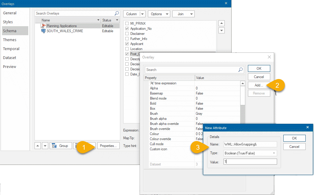
Snapping requires features to be pushed to the client from GeognoSIS. Most datasets can be used for snapping but the following recommendations should be taken into consideration:
- SQL Server, PostGIS or Oracle overlays are ideal (not Cadcorp fdb or bds)
- When snapping to OS MasterMap data, a lightweight snapping layer should be created by copying line work from the OS MasterMap table to a separate table. Do not use a filtered or phased overlay.
- Only one overlay should be defined as the snapping overlay.