Set up OGC Services
The Open Geospatial Consortium (OGC) provides simple protocols for:
- Requesting map images from one or more distributed geospatial databases (WMS or the Web Map Service).
- Requesting geographical features independent of platforms (WFS or Web Feature Sevice)
To use them on WebMap, data using these protocols should first be loaded using GeognoSIS Manager.
Note: You can add raw data files and SWDs; however we strongly recommend SWDs as they are configurable and can hold multiple overlays.
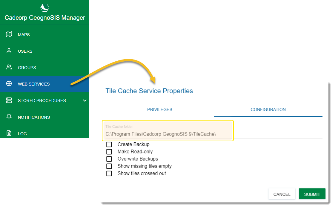
GeognoSIS caches the tiles downloaded to client machines as they pan across the map.
These cached tiles are stored on the server and available for other users on different client machines.
Using cached tiles gives you a faster mapping experience. Customise the location of these cached tiles in GeognoSIS Manager. Select Web Services > Tile Cache Service Properties > Configuration.
We recommend using WMS for both base mapping and map layers; WMS is easy to set up and responds quickly when data is viewed within the website.
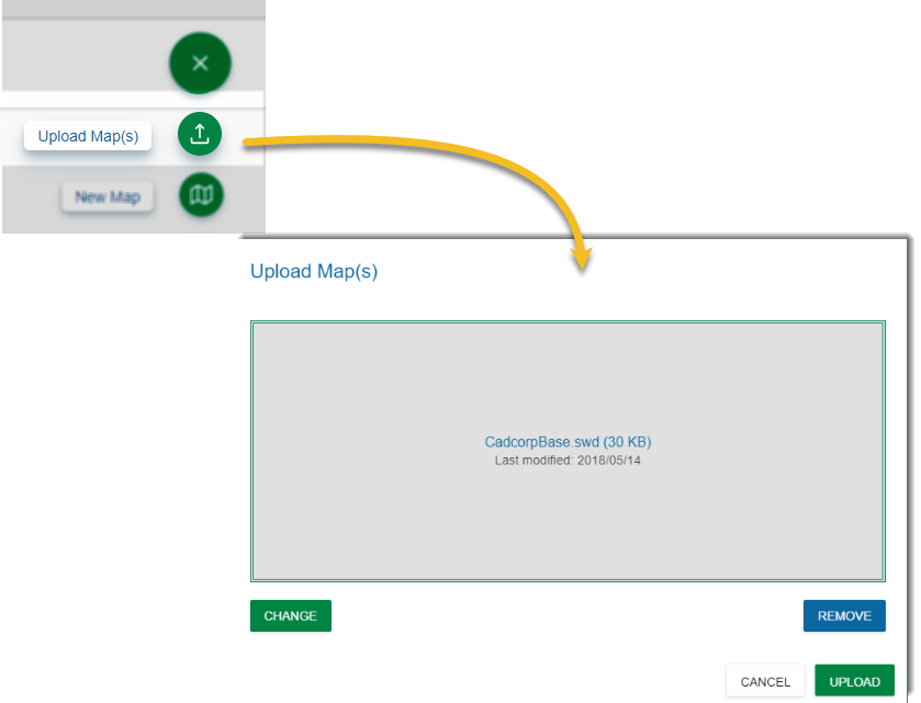
- Set up a new instance on GeognoSIS manager. Click here for more information

- Click Upload Map and select your SWD.
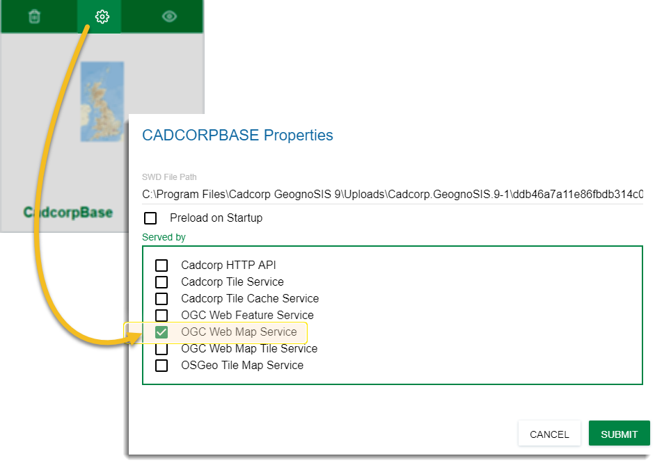
- Once the data file has been loaded, click Properties and tick the OGC Web Map Services checkbox.
- Click Submit.
Note: You can use data files instead of SWDs to set up Web Map Services. However you may experience some loss of functionality e.g., scale thresholding.
To view the data files right click on OGC Web Map Service and choose Refresh. To view an individual data file, click View  at the top of the uploaded map. To view all WMS maps, go to Web Services > OGC > Web Map Service and click the View button.
Also this section ends on a colon. The data can be pre-viewed under OGC Web Map Service or under All Data Files.
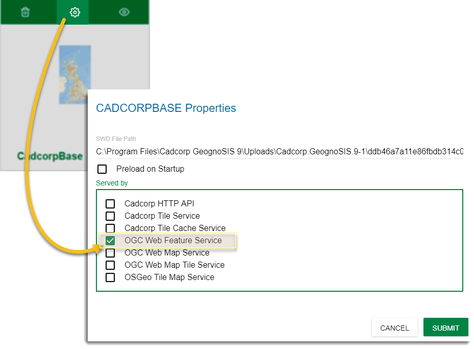
WFS is particularly handy for small or light datasets.
Setting up data to be served out via WFS is similar to setting up a WMS; follow the steps detailed above.
Once you have loaded the data, remember to click Properties and tick the OGC Web Map Services checkbox.