Data Layers
Data Layers are mapping layers you can see and interrogate. You can view these layers in WebMap’s Map Features and also turn them on/off.

Data Layers come from many sources:
- GeognoSIS SIS Workspace Definition (Recommended)
- OGC WMS (Recommended)
- OGC WFS
- ESRI REST API
We recommend using a GeognoSIS SIS Workspace Definition (SWD) for Data Layers. SWDs make it easier to:
- Identify layers to be used for Search by Area queries
- Define datasets from locally sourced files and databases and also to style and structure the data exactly to your requirements.
- Include options to build legends for display of data and
- Determine which attributes can be viewed by the user.
Additional Data Layers from third party sources can be added as OGC WMS services. Create Data Layers using Add Layer.option. To display data overlays in WebMap’s Map Features simply enable the Include in Layer Tree checkbox.
Due to open layers v2 restrictions, the number of layers WebMap can handle is restricted to 200.
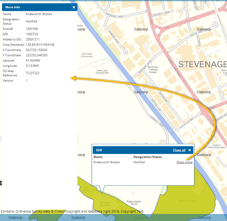
Feature information
Users can click a map feature to see relevant information. This information is extracted from the first two schema columns of the data layer. If there are more than two schema columns, the Show More link is displayed on the user map.
TIP: See also More Mapping 