OGC Web Feature Service (WFS)
The Web Feature Service (WFS) allows vector data to be served using the OGC WFS Web Feature Service 1.0.0. To add data to GeognoSIS see here.
Options are available inside an instance to :
- Grant privileges
- View the map being used by the service
Click Edit on an instance and select Web Services > OGC > Web Feature Service.
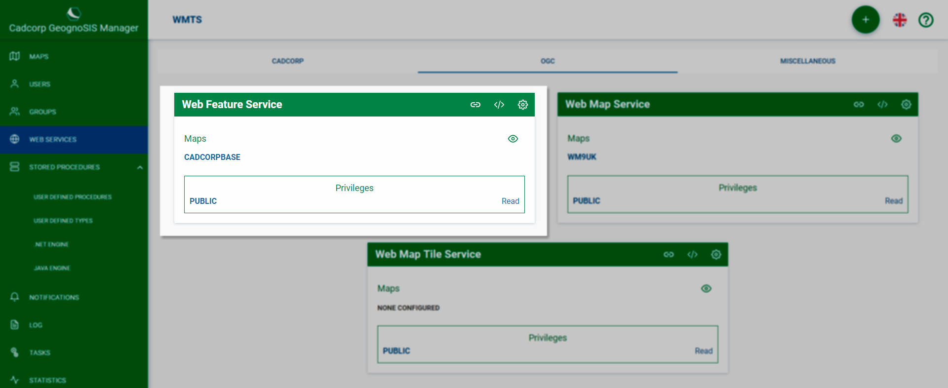
Options
To define read privileges, click Options ![]() > Privileges. Select desired users/groups from the drop-down menu.
> Privileges. Select desired users/groups from the drop-down menu.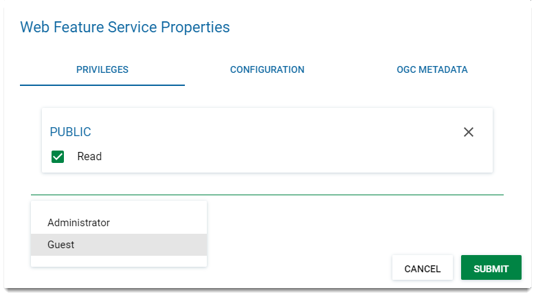
To edit OGC definitions, click Options ![]() > Configuration.
> Configuration.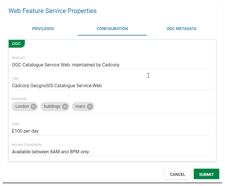
| Field | Description |
| Abstract | The OGC service and who maintains the service. |
| Title | Title of the service as selected in the Service field. |
| Keywords | Keywords and keyword phrases for the specific page. (eg London, Buildings, Rivers) |
| Fees | Chargeable amount per day, pcm or annually (Eg £100 per day) |
| Access Constraints | Access constraints on the service (eg Available only from midnight Saturday or only for members of XY club) |
Click Submit.
Data added here is purely for information and will be included in the WFS capabilities document. Fees or access constraints are not validated.
To include other metadata, click Options ![]() > OGC Metadata.
> OGC Metadata.
To serve data using the INSPIRE Profile rather than the OGC Profile, enable the option on this screen. Contact Information added here will be included in the WFS capabilities document.
URL
To discover the path used for the OGC WFS you have just created, click the URL icon ![]()

Capabilities
A capabilities document is an XML document containing information about geographic content offered by the server. The document is generated by the WFS or WMS server in response to a specific request and shows published feature types (like roads or rivers) and any supported operations (like insert and delete).
Select Capabilities ![]() to view the capabilities document for this service.
to view the capabilities document for this service.